
 Français
 Italiano
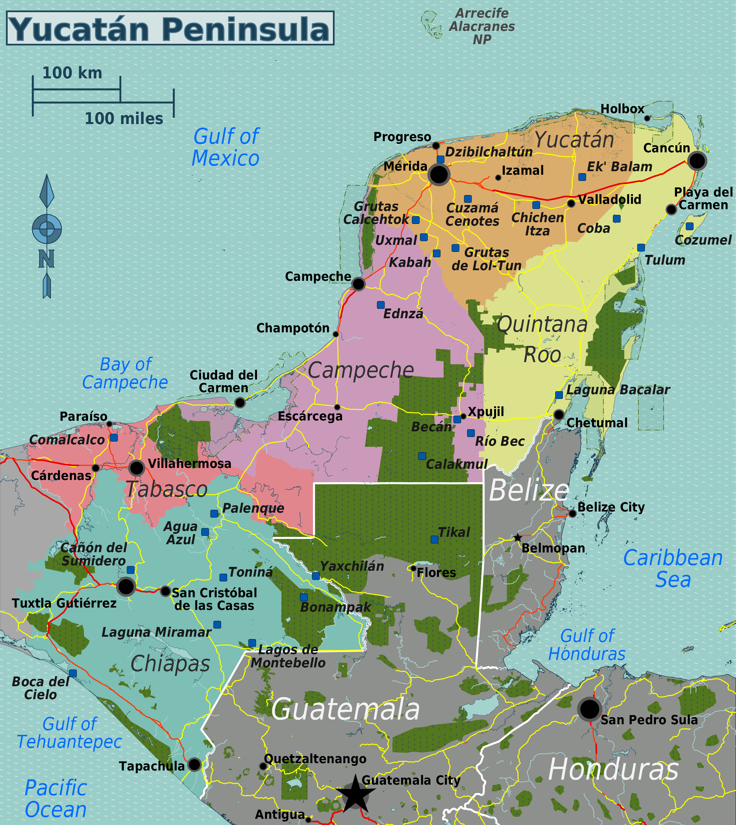
Size of this preview: 535 × 599 pixels. Other resolutions: 214 × 240 pixels | 429 × 480 pixels | 686 × 768 pixels | 914 × 1,024 pixels | 2,500 × 2,800 pixels.
Original file (2,500 × 2,800 pixels, file size: 2.53 MB, MIME type: image/png)
This is a file from the Wikimedia Commons and may be used by other projects. Information from its description page there is shown below. Commons is a freely licensed media file repository. |
| Description | English: Travel map of the Yucatán Peninsula | |||
| Date | ||||
| Source | File:Yucatán_Peninsula_map.svg | |||
| Author | Peter Fitzgerald, OpenStreetMap | |||
| Permission (Reusing this file) | This file is licensed under the Creative Commons Attribution-Share Alike 2.0 Generic license.
|
File history
Click on a date/time to view the file as it appeared at that time.
| Date/Time | Thumbnail | Dimensions | User | Comment | |
|---|---|---|---|---|---|
| current | 21:51, 9 June 2013 | | 2,500 × 2,800 (2.53 MB) | Peterfitzgerald | {{Information |Description ={{en|1=Travel map of the Yucatán Peninsula}} |Source =File:Yucatán_Peninsula_map.svg |Author =Peter Fitzgerald, [http://openstreetmap.org OpenStreetMap] |Date =201... |
File usage
The following page uses this file:
Global file usage
The following other wikis use this file:
- Usage on el.wikivoyage.org
- Usage on fr.wikivoyage.org
- Usage on he.wikivoyage.org
- Usage on hu.wikipedia.org
- Usage on it.wikivoyage.org
- Usage on zh.wikivoyage.org
Metadata
Explore the world

United states
New York

Japan
Tokyo

Singapore
Singapore
