
 Français
 Italiano
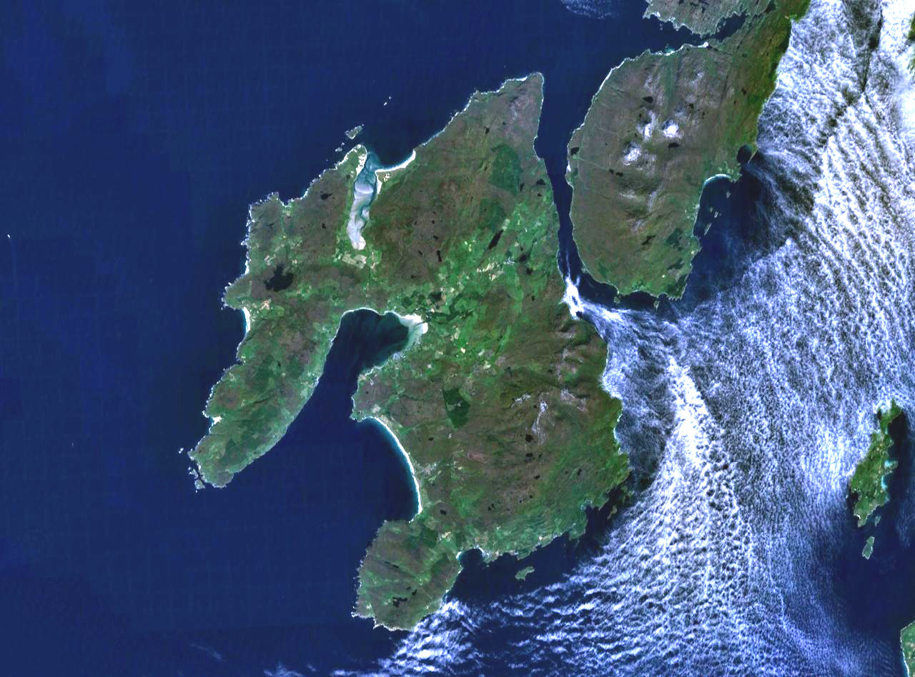
Size of this preview: 800 × 593 pixels. Other resolutions: 320 × 237 pixels | 640 × 474 pixels | 1,024 × 758 pixels | 1,280 × 948 pixels.
Original file (1,280 × 948 pixels, file size: 285 KB, MIME type: image/jpeg)
This is a file from the Wikimedia Commons and may be used by other projects. Information from its description page there is shown below. Commons is a freely licensed media file repository. |
Summary
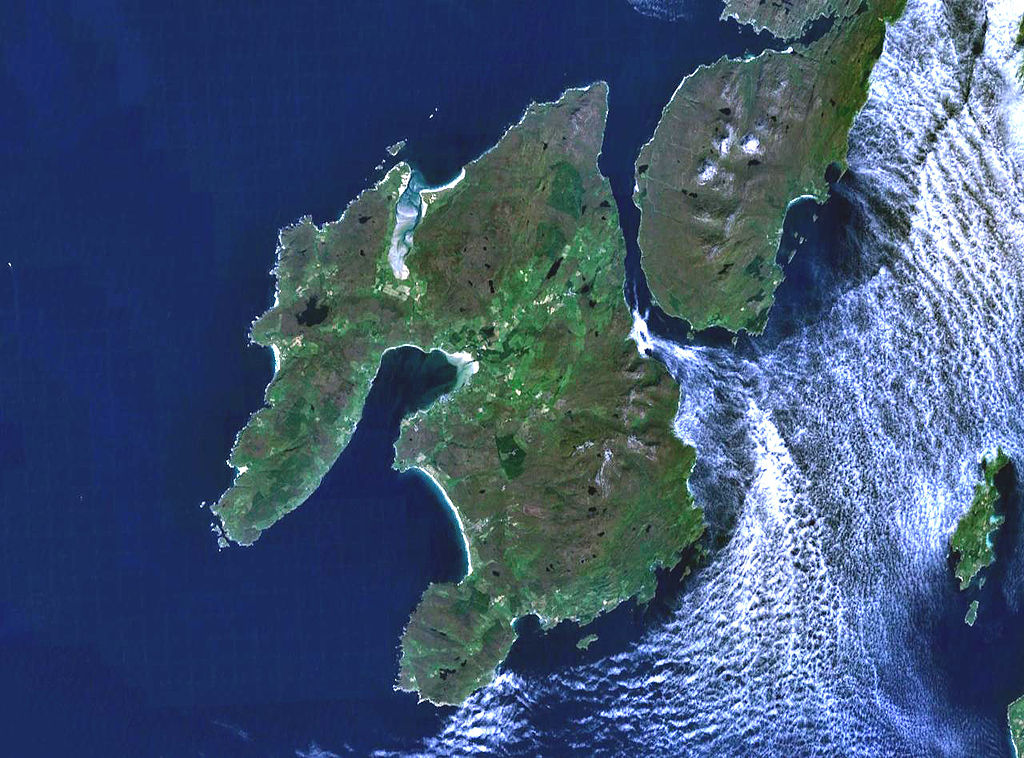
The island of Islay off the west coast of Scotland. The south part of the neighbouring island if Jura is visible to the northeast, and on the far east (right) of frame is the small island of Gigha.
Landsat 7 image, collected using NASA World Wind.

Licensing
| This image is in the public domain because it is a screenshot from NASA’s globe software World Wind using a public domain layer, such as Blue Marble, MODIS, Landsat, SRTM, USGS or GLOBE.
|  |
File history
Click on a date/time to view the file as it appeared at that time.
| Date/Time | Thumbnail | Dimensions | User | Comment | |
|---|---|---|---|---|---|
| current | 19:28, 4 August 2005 | | 1,280 × 948 (285 KB) | Finlay McWalter | The island of Islay off the west coast of Scotland. Landsat 7 image, collected using NASA World Wind. {{PD-USGov-NASA}} category:islands |
File usage
The following 3 pages use this file:
Global file usage
The following other wikis use this file:
- Usage on ar.wikipedia.org
- Usage on arz.wikipedia.org
- Usage on br.wikipedia.org
- Usage on ca.wikipedia.org
- Usage on cy.wikipedia.org
- Usage on da.wikipedia.org
- Usage on de.wikipedia.org
- Usage on de.wikivoyage.org
- Usage on en.wikipedia.org
- Argyll and Bute
- Islay single malts
- Lagavulin distillery
- Port Ellen
- Port Ellen distillery
- Bowmore distillery
- Lagavulin
- Laphroaig distillery
- User:Chino
- Islay Airport
- Ardbeg distillery
- Bowmore
- Bruichladdich distillery
- Kilchoman distillery
- Port Charlotte, Islay
- Caol Ila distillery
- Port Askaig
- Portnahaven
- The Oa
- Rinns of Islay
- Bridgend, Islay
- Bunnahabhain
- User:Mike McGregor (Can)
- User:Pradiptaray
- Kilarrow Parish Church
- Eilean Mhic Coinnich
- Easter Ellister
- Ballygrant
- User:Tomyumgoong
- User:MJBurrage
- User:Svartalf
- User:UBX/User prefers Islay Malts
- User:Mike McGregor (Can)/code page
- User:A435(m)
- User:Jgp
- User:CzechOut
- User:Lindisfarne~enwiki
- User:AndreaPersephone
- User:NJW494
View more global usage of this file.
Metadata
Explore the world

United states
New York

Japan
Tokyo

Singapore
Singapore
