
 Français
 Italiano
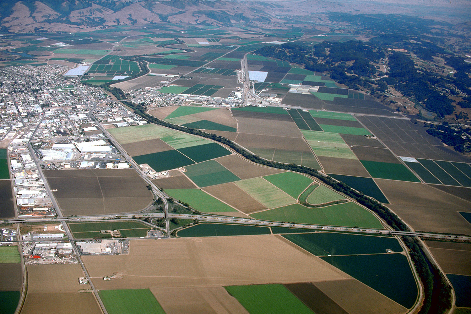
Size of this preview: 800 × 533 pixels. Other resolutions: 320 × 213 pixels | 640 × 426 pixels | 1,024 × 682 pixels | 1,500 × 999 pixels.
Original file (1,500 × 999 pixels, file size: 653 KB, MIME type: image/jpeg)
This is a file from the Wikimedia Commons and may be used by other projects. Information from its description page there is shown below. Commons is a freely licensed media file repository. |
| Description | English: Aerial view of Watsonville, California, USA and the agricultural areas surrounding the town. This photograph shows only the southern section, about one quarter of the town. Coordinates: 36°54′4.73″N 121°45′24.62″W / 36.9013139°N 121.7568389°W
| ||
| Date | not specified or unknown | ||
| Source | U.S. Army Corps of Engineers Digital Visual Library Image page Image description page Digital Visual Library home page | ||
| Author | Robert Campbell | ||
| Permission (Reusing this file) |
This file is licensed under the Creative Commons Attribution-Share Alike 3.0 Unported license.
| ||
| Location | Watsonville, Santa Cruz County, California, USA |

[[Category:Fields in California|Pajaro]
File history
Click on a date/time to view the file as it appeared at that time.
| Date/Time | Thumbnail | Dimensions | User | Comment | |
|---|---|---|---|---|---|
| current | 03:38, 3 May 2007 | | 1,500 × 999 (653 KB) | DanMS | {{Information | Description = {{en|Aerial view of Watsonville, California, USA and the agricultural areas surrounding the town. This photograph shows only the southern section, about one quarter of the town. The Pajaro river meanders across the plain f |
File usage
There are no pages that use this file.
Global file usage
The following other wikis use this file:
- Usage on arz.wikipedia.org
- Usage on azb.wikipedia.org
- Usage on ceb.wikipedia.org
- Usage on en.wikipedia.org
- Usage on it.wikipedia.org
- Usage on ja.wikipedia.org
- Usage on ro.wikipedia.org
- Usage on www.wikidata.org
Metadata
Explore the world

United states
New York

Japan
Tokyo

Singapore
Singapore
