
 Français
 Italiano
Size of this preview: 800 × 522 pixels. Other resolutions: 320 × 209 pixels | 640 × 418 pixels | 1,024 × 668 pixels | 1,280 × 835 pixels | 2,560 × 1,670 pixels | 4,530 × 2,956 pixels.
Original file (4,530 × 2,956 pixels, file size: 10.64 MB, MIME type: image/jpeg)
This is a file from the Wikimedia Commons and may be used by other projects. Information from its description page there is shown below. Commons is a freely licensed media file repository. |
Summary
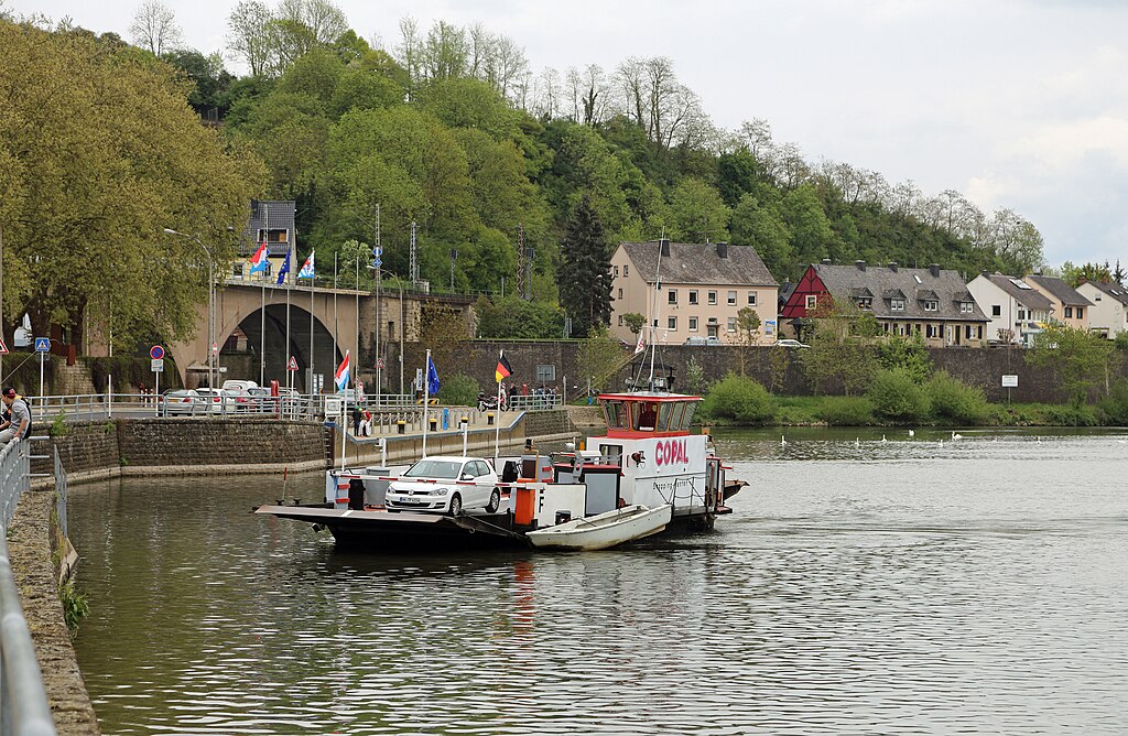
| Description | Nederlands: Wasserbillig (Groothertogdom Luxemburg): veerpont op de Moezel tussen Wasserbillig en Oberbillig (Duitsland). Achtergrond: de spoorbrug over de Sûre (of Sauer), op de grens tussen Luxemburg en Duitsland, en het gehucht Wasserbilligerbrück (gem. Langsur, Duitsland). English: Wasserbillig (Grand Duchy of Luxembourg): the ferry on the Moselle river between Wasserbillig and Oberbillig (Germany). Background: the railway bridge on the Sûre (or Sauer) river, on the border between Luxembourg and Germany, and the hamlet of Wasserbilligerbrück (municipality of Langsur, Germany). Français : Wasserbillig (Grand Duché de Luxembourg) : le bac sur la Moselle reliant Wasserbillig à Oberbillig (Allemagne). Au fond: le pont ferroviaire sur la Sûre, sur la frontière entre le Luxembourg et l'Allemagne, et le hameau de Wasserbilligerbrück (commune de Langsur, Allemagne) |
| Date | |
| Source | Own work |
| Author | Marc Ryckaert |
| Camera location | | View this and other nearby images on: OpenStreetMap |
|---|
Licensing
I, the copyright holder of this work, hereby publish it under the following license:
This file is licensed under the Creative Commons Attribution 3.0 Unported license.
- You are free:
- to share – to copy, distribute and transmit the work
- to remix – to adapt the work
- Under the following conditions:
- attribution – You must give appropriate credit, provide a link to the license, and indicate if changes were made. You may do so in any reasonable manner, but not in any way that suggests the licensor endorses you or your use.
File history
Click on a date/time to view the file as it appeared at that time.
| Date/Time | Thumbnail | Dimensions | User | Comment | |
|---|---|---|---|---|---|
| current | 20:56, 29 May 2015 | | 4,530 × 2,956 (10.64 MB) | MJJR | User created page with UploadWizard |
File usage
The following page uses this file:
Metadata
Explore the world

United states
New York

Japan
Tokyo

Singapore
Singapore
