
 Français
 Italiano
Size of this PNG preview of this SVG file: 502 × 600 pixels. Other resolutions: 201 × 240 pixels | 402 × 480 pixels | 643 × 768 pixels | 857 × 1,024 pixels | 1,714 × 2,048 pixels | 1,047 × 1,251 pixels.
Original file (SVG file, nominally 1,047 × 1,251 pixels, file size: 153 KB)
This is a file from the Wikimedia Commons and may be used by other projects. Information from its description page there is shown below. Commons is a freely licensed media file repository. |
Summary
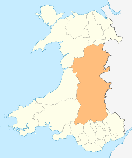
| Description | Deutsch: Lagekarte von Powys in Wales English: Locator map of Powys in Wales |
| Date | |
| Source | Own work |
| Author | NordNordWest |
| Permission (Reusing this file) | I, the copyright holder of this work, hereby publish it under the following license: This file is licensed under the Creative Commons Attribution-Share Alike 3.0 Unported license.
|
| Other versions | Derivative works of this file: 2011 Welsh Devolution Referendum results map.PNG |
 | This map has been made or improved in the German Kartenwerkstatt (Map Lab). You can propose maps to improve as well. |
File history
Click on a date/time to view the file as it appeared at that time.
| Date/Time | Thumbnail | Dimensions | User | Comment | |
|---|---|---|---|---|---|
| current | 18:57, 4 May 2010 | | 1,047 × 1,251 (153 KB) | NordNordWest | {{int:filedesc}} {{Information |Description= {{de|Lagekarte von Powys in Wales}} {{en|Locator map of Powys in Wales}} |Source={{Own}} |Date=2010-05-04 |Author={{U|NordNordWest}} |Permission={{self|cc-by-sa-3.0}} |other_versions= }} {{Kartenwerkstatt}} [[ |
File usage
There are no pages that use this file.
Global file usage
The following other wikis use this file:
- Usage on br.wikipedia.org
- Usage on en.wikipedia.org
- Hay-on-Wye
- Llansantffraed
- Powys
- Berwyn range
- Brecon
- Welshpool
- Elan Valley Reservoirs
- Machynlleth
- Llan, Powys
- Llanrhaeadr-ym-Mochnant
- Llanidloes
- Knighton, Powys
- New Radnor
- Presteigne
- Rhayader
- Builth Wells
- Llangammarch Wells
- Llanwrtyd Wells
- Llandrindod Wells
- Llanwrtyd
- Llangammarch (parish)
- Montgomery, Powys
- Crickhowell
- Talgarth
- Ystradfellte
- Ystradgynlais
- Llandrinio
- Caersws
- Pontdolgoch
- Powis Castle
- Lake Vyrnwy
- Llanfair Caereinion
- Llanymynech
- Criggion
- Llanelwedd
- Meifod
- Cwmtwrch
- Bwlch
- Llanfihangel Nant Brân
- Trecastle
- River Rhaeadr
- Craig Cerrig-gleisiad
- Fan Frynych
- List of places in Powys
- Bettws Cedewain
- River Vyrnwy
- Beulah, Powys
- Talybont-on-Usk
- Bronllys
View more global usage of this file.
Explore the world

United states
New York

Japan
Tokyo

Singapore
Singapore
