
 Français
 Italiano
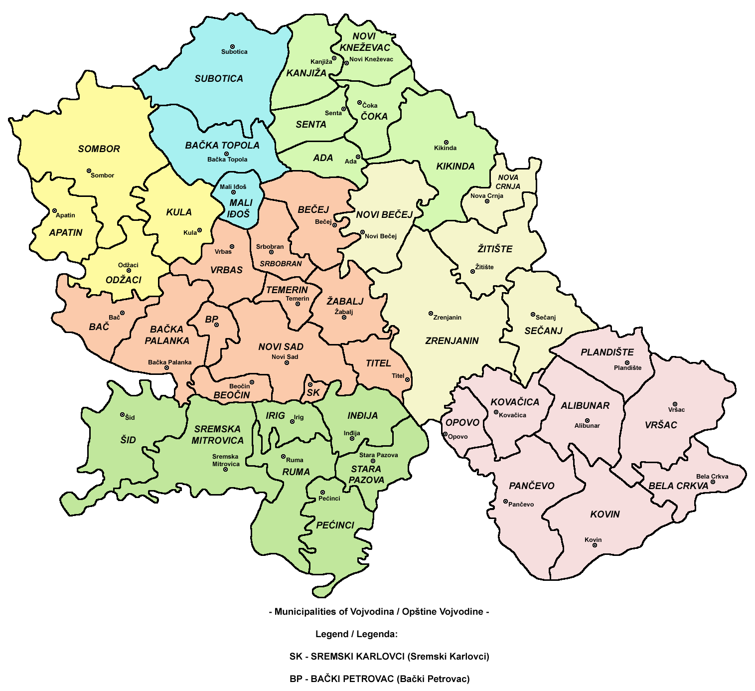
Size of this preview: 655 × 599 pixels. Other resolutions: 262 × 240 pixels | 525 × 480 pixels | 840 × 768 pixels | 1,119 × 1,024 pixels | 1,515 × 1,386 pixels.
Original file (1,515 × 1,386 pixels, file size: 183 KB, MIME type: image/png)
This is a file from the Wikimedia Commons and may be used by other projects. Information from its description page there is shown below. Commons is a freely licensed media file repository. |
 | This map image could be re-created using vector graphics as an SVG file. This has several advantages; see Commons:Media for cleanup for more information. If an SVG form of this image is available, please upload it and afterwards replace this template with {{vector version available|new image name}}.It is recommended to name the SVG file “Vojvodina municipalities map.svg”—then the template Vector version available (or Vva) does not need the new image name parameter. |
Summary
| Description | English: map of municipalities of Vojvodina Српски / srpski: мапа општина Војводине Русский: карта муниципалитетов Воеводины |
| Date | 14 February 2009 (original upload date) |
| Source | Own work |
| Author | WikiEditor2004 |
References
- Slobodan Radovanović, Geografski atlas, Magic Map, Smederevska Palanka, 2001.
- Školski geografski atlas, Intersistem Kartografija, Beograd, 2004.
- Denis Šehić - Demir Šehić, Geografski atlas Srbije, Beograd, 2007.
Licensing
| I, the copyright holder of this work, release this work into the public domain. This applies worldwide. In some countries this may not be legally possible; if so: I grant anyone the right to use this work for any purpose, without any conditions, unless such conditions are required by law. |
File history
Click on a date/time to view the file as it appeared at that time.
| Date/Time | Thumbnail | Dimensions | User | Comment | |
|---|---|---|---|---|---|
| current | 14:34, 22 September 2009 | | 1,515 × 1,386 (183 KB) | WikiEditor2004 | improved version |
| 19:52, 14 February 2009 |  | 970 × 794 (208 KB) | WikiEditor2004 | map of municipalities of Vojvodina (self made) {{PD-self}} Category:Maps of Vojvodina |
File usage
There are no pages that use this file.
Global file usage
The following other wikis use this file:
- Usage on bs.wikipedia.org
- Usage on ca.wikipedia.org
- Usage on el.wikipedia.org
- Usage on en.wikipedia.org
- Sremski Karlovci
- Belgrade
- Novi Sad
- Kragujevac
- Šabac
- Vojvodina
- Subotica
- Pančevo
- Petrovaradin
- Zemun
- Bačka Palanka
- Bečej
- Čačak
- Ćuprija
- Gornji Milanovac
- Inđija
- Jagodina
- Kikinda
- Kraljevo
- Kruševac
- Lazarevac
- Mladenovac
- Novi Pazar
- Obrenovac
- Paraćin
- Priboj
- Ruma
- Senta
- Sombor
- Sremska Mitrovica
- Užice
- Vršac
- Zrenjanin
- Sopot, Belgrade
- Krupanj
- Svilajnac
- Kovačica
- Bački Petrovac
- New Belgrade
- Savski Venac
- Ljig
- Palilula, Belgrade
View more global usage of this file.
Explore the world

United states
New York

Japan
Tokyo

Singapore
Singapore
