Size of this preview: 800 × 598 pixels. Other resolutions: 320 × 239 pixels | 640 × 478 pixels | 1,024 × 765 pixels | 1,280 × 956 pixels | 1,748 × 1,306 pixels.
Original file (1,748 × 1,306 pixels, file size: 1.26 MB, MIME type: image/jpeg)
File history
Click on a date/time to view the file as it appeared at that time.
| Date/Time | Thumbnail | Dimensions | User | Comment | |
|---|---|---|---|---|---|
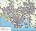
| current | 19:56, 15 January 2013 |  | 1,748 × 1,306 (1.26 MB) | Janwillemvanaalst | Added various topographic improvements, which were already available in the BRT open-geodata source files: - Symbols for special physical appearances of land types such as "swampy terrain" - Symbol for carpool parking + large open parking spaces (in ad... |
| 12:10, 6 January 2013 |  | 1,747 × 1,307 (1.19 MB) | Janwillemvanaalst | Various rendering improvements, following the advice of several topographic experts. Scale remains unchanged. | |
| 14:33, 30 December 2012 |  | 1,747 × 1,307 (1.16 MB) | Janwillemvanaalst | Map redrawn using updated (Dec. 2012) open geodata Dutch government base registries BRT + BAG. Rendered using QuantumGIS and Photoshop. | |
| 15:43, 17 March 2012 |  | 2,443 × 1,962 (1.49 MB) | Janwillemvanaalst | Various corrections on pedestrian areas. | |
| 19:36, 16 March 2012 |  | 2,443 × 1,962 (1.49 MB) | Janwillemvanaalst | Building polygons now taken from Open Geodata BAG registry (Jan. 2012); increased image resolution. | |
| 20:16, 15 February 2012 |  | 1,601 × 1,345 (1,004 KB) | Janwillemvanaalst |
File usage
The following page uses this file:
Global file usage
The following other wikis use this file:
- Usage on cs.wikipedia.org


 Français
 Italiano


