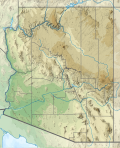
Size of this PNG preview of this SVG file: 487 × 599 pixels. Other resolutions: 195 × 240 pixels | 390 × 480 pixels | 624 × 768 pixels | 832 × 1,024 pixels | 1,664 × 2,048 pixels | 893 × 1,099 pixels.
Original file (SVG file, nominally 893 × 1,099 pixels, file size: 2.51 MB)
File history
Click on a date/time to view the file as it appeared at that time.
| Date/Time | Thumbnail | Dimensions | User | Comment | |
|---|---|---|---|---|---|
| current | 23:21, 29 January 2021 |  | 893 × 1,099 (2.51 MB) | SANtosito | Uploaded own work with UploadWizard |
File usage
There are no pages that use this file.
Global file usage
The following other wikis use this file:
- Usage on ca.wikipedia.org
- Usage on de.wikipedia.org
- Antelope Canyon
- Mount Graham (Arizona)
- Lake Powell
- Lake Mohave
- Glen Canyon Dam
- San Carlos Lake
- El Capitan (Berg, Arizona)
- Theodore Roosevelt Lake
- Canyon Lake (Arizona)
- Saguaro Lake
- Apache Lake
- Bartlett Lake
- Mount Hopkins (Arizona)
- Santa Rita Mountains
- San Francisco Peaks
- Mount Wrightson
- Red Butte
- Humphreys Peak
- Pusch Ridge
- Santa Catalina Mountains
- Bear Canyon
- Lyman Lake
- Tempe Town Lake
- Reservation Lake
- Alamo Lake
- Patagonia Lake
- Upper Lake Mary
- Long Lake (Arizona)
- Mormon Lake
- Lake Pleasant (Arizona)
- Many Farms Lake
- Wheatfields Lake
- Willow Springs Lake
- Black Canyon Lake
- Bear Canyon Lake
- Mingus Mountain
- Cabeza Prieta Mountains
- Peloncillo Mountains
- Puerto Blanco Mountains
- Vorlage:Positionskarte USA Arizona
- Gila Mountains
- Agassiz Peak
- Homolovi State Park
- Kartchner Caverns State Park
- Tucson Mountains
- Yuma Territorial Prison State Historic Park
- Boyce Thompson Arboretum State Park
- Tonto Natural Bridge State Park
View more global usage of this file.


 Français
 Italiano


