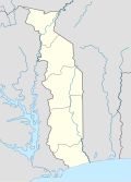
Size of this PNG preview of this SVG file: 425 × 590 pixels. Other resolutions: 173 × 240 pixels | 346 × 480 pixels | 553 × 768 pixels | 737 × 1,024 pixels | 1,475 × 2,048 pixels.
Original file (SVG file, nominally 425 × 590 pixels, file size: 111 KB)
File history
Click on a date/time to view the file as it appeared at that time.
| Date/Time | Thumbnail | Dimensions | User | Comment | |
|---|---|---|---|---|---|
| current | 14:51, 24 March 2024 |  | 425 × 590 (111 KB) | GrandEscogriffe | cleaner border |
| 14:31, 24 March 2024 |  | 425 × 590 (110 KB) | GrandEscogriffe | more correct north-south stretching | |
| 19:49, 7 November 2009 |  | 425 × 624 (131 KB) | Daryona | Thicker borders | |
| 19:38, 7 November 2009 |  | 425 × 624 (131 KB) | Daryona | {{Information |Description={{en|1=Location map of Togo}} {{ru|1=Позиционная карта Того}} |Source={{own}} |Author=Daryona |Date=2009-10-07 |Permission= |other_versions= }} Main data source: [[:File:Togo-karte-politisch. |
File usage
There are no pages that use this file.
Global file usage
The following other wikis use this file:
- Usage on af.wikipedia.org
- Usage on an.wikipedia.org
- Usage on ar.wikipedia.org
- Usage on ast.wikipedia.org
- Usage on azb.wikipedia.org
- Usage on az.wikipedia.org
- Usage on ba.wikipedia.org
- Usage on bcl.wikipedia.org
- Usage on be-tarask.wikipedia.org
- Usage on be.wikipedia.org
- Usage on bg.wikipedia.org
- Usage on bn.wikipedia.org
- Usage on bs.wikipedia.org
- Usage on ca.wikipedia.org
- Usage on ceb.wikipedia.org
View more global usage of this file.


 Français
 Italiano


