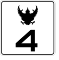
Size of this PNG preview of this SVG file: 512 × 512 pixels. Other resolutions: 240 × 240 pixels | 480 × 480 pixels | 768 × 768 pixels | 1,024 × 1,024 pixels | 2,048 × 2,048 pixels.
Original file (SVG file, nominally 512 × 512 pixels, file size: 25 KB)
File history
Click on a date/time to view the file as it appeared at that time.
| Date/Time | Thumbnail | Dimensions | User | Comment | |
|---|---|---|---|---|---|
| current | 15:26, 12 August 2022 |  | 512 × 512 (25 KB) | Boyz 1412 | ปรับปรุงใหม่ |
| 14:38, 4 January 2021 |  | 512 × 512 (25 KB) | Boyz 1412 | ปรับปรุงใหม่ | |
| 15:46, 27 July 2020 |  | 900 × 900 (36 KB) | มองโกเลีย๔๔ | ปรับปรุงส่วนพญาครุฑให้สอดคล้องตามมาตรฐานของกรมทางหลวงได้กำหนดไว้ | |
| 18:24, 31 December 2017 |  | 900 × 900 (11 KB) | Boyz 1412 | ใช้แบบมาตรฐานทางหลวง | |
| 06:55, 4 December 2017 |  | 775 × 776 (20 KB) | Boyz 1412 | ||
| 06:23, 17 November 2017 |  | 2,000 × 2,000 (203 KB) | มองโกเลีย๔๔ | แก้ไขตามกรมทางหลวง | |
| 05:01, 17 September 2007 |  | 775 × 776 (20 KB) | Watcharakorn | {{Thailand Route Shields|4}} {{Information |Description= Thailand Highway shield (4) |Source= Create by myself |Date= 2007-09-17 |Author= User:Watcharakorn |Permission= Public Domain |other_versions= }} |
File usage
The following 19 pages use this file:
Global file usage
The following other wikis use this file:
- Usage on bn.wikivoyage.org
- Usage on de.wikipedia.org
- Usage on en.wikipedia.org
- BTS Skytrain
- MRT (Bangkok)
- Mass Rapid Transit Authority of Thailand
- State Railway of Thailand
- Hua Lamphong railway station
- North–South Expressway Northern Route
- List of highways numbered 4
- Malaysia Federal Route 7
- Phet Kasem Road
- AH2
- Airport Rail Link (Bangkok)
- Highway 41 (Thailand)
- Khlong Saen Saep boat service
- Chao Phraya Express Boat
- Sukhumvit Line
- Silom Line
- Bangkok Mass Transit Authority
- SRT Red Lines
- Thai highway network
- Padang Besar–Sadao Highway
- Template:Public transport in Bangkok
- Water transport in Bangkok
- Orange Line (Bangkok)
- Purple Line (Bangkok)
- Yellow Line (Bangkok)
- Brown Line (Bangkok)
- Pink Line (Bangkok)
- Bangkok Elevated Road and Train System
- SRT Dark Red Line
- SRT Light Red Line
- Wongwian Yai BTS station
- Transport in Bangkok
- Bangkok BRT
- Blue Line (Bangkok)
- Grey Line (Bangkok)
- Light Blue Line (Bangkok)
- Mass Rapid Transit Master Plan in Bangkok Metropolitan Region
- User:Mauk111/Rapid Transit and Rail2
- User:Sfalpha
- List of rapid transit stations in Bangkok
- Rail transport in Bangkok
View more global usage of this file.


 Français
 Italiano


