
 Français
 Italiano
Size of this PNG preview of this SVG file: 564 × 600 pixels. Other resolutions: 226 × 240 pixels | 451 × 480 pixels | 722 × 768 pixels | 963 × 1,024 pixels | 1,925 × 2,048 pixels | 940 × 1,000 pixels.
Original file (SVG file, nominally 940 × 1,000 pixels, file size: 255 KB)
This is a file from the Wikimedia Commons and may be used by other projects. Information from its description page there is shown below. Commons is a freely licensed media file repository. |
Summary
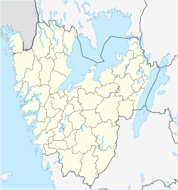
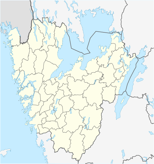
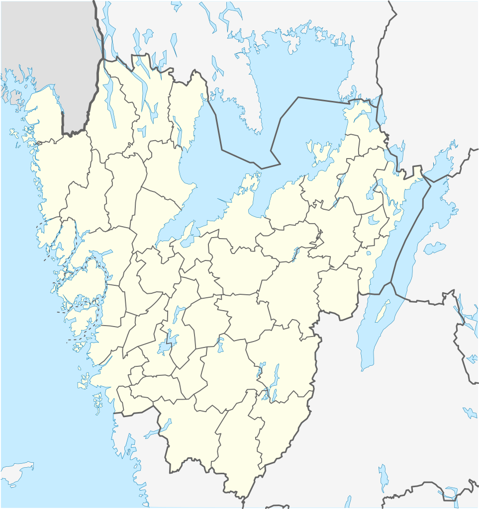
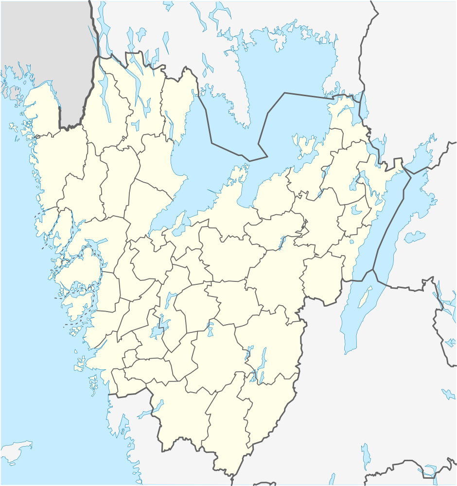
| Description | English: Location map of Västra Götaland in Sweden Equirectangular projection, N/S stretching 190 %. Geographic limits of the map:
Deutsch: Positionskarte von Västra Götaland in Schweden Quadratische Plattkarte, N-S-Streckung 190 %. Geographische Begrenzung der Karte:
Svenska: Karta över Västra Götaland i Sverige Equirectangular projection, N / S sträcker sig 190%. Geografiska gränser för kartan:
|
| Date | |
| Source | Own work |
| Author | Erik Frohne |
Licensing
I, the copyright holder of this work, hereby publish it under the following licenses:
 | Permission is granted to copy, distribute and/or modify this document under the terms of the GNU Free Documentation License, Version 1.2 or any later version published by the Free Software Foundation; with no Invariant Sections, no Front-Cover Texts, and no Back-Cover Texts. A copy of the license is included in the section entitled GNU Free Documentation License. |
This file is licensed under the Creative Commons Attribution 3.0 Unported license.
- You are free:
- to share – to copy, distribute and transmit the work
- to remix – to adapt the work
- Under the following conditions:
- attribution – You must give appropriate credit, provide a link to the license, and indicate if changes were made. You may do so in any reasonable manner, but not in any way that suggests the licensor endorses you or your use.
You may select the license of your choice.
File history
Click on a date/time to view the file as it appeared at that time.
| Date/Time | Thumbnail | Dimensions | User | Comment | |
|---|---|---|---|---|---|
| current | 09:16, 28 January 2025 | | 940 × 1,000 (255 KB) | Boivie | adjusting border between Grästorp and Vänersborg |
| 12:37, 11 December 2011 |  | 940 × 1,000 (255 KB) | Esquilo | Added municipal border between Skövde and Tibro. | |
| 08:55, 27 January 2009 |  | 940 × 1,000 (254 KB) | Erik Frohne | Adjusted waterline | |
| 07:28, 22 January 2009 |  | 940 × 1,000 (253 KB) | Erik Frohne | {{Information |Description={{en|1=Location map of Västra Götaland in Sweden Equirectangular projection, N/S stretching 190 %. Geographic limits of the map: * N: 59.50° N * S: 57.10° N * W: 10.90° E * E: 15.20° E }} {{de|1=Positionskarte von Västr |
File usage
There are no pages that use this file.
Global file usage
The following other wikis use this file:
- Usage on ar.wikipedia.org
- Usage on arz.wikipedia.org
- Usage on bg.wikipedia.org
- Гьотеборг
- Карлсбори
- Ю (град)
- Шьовде
- Бурос
- Тролхетан
- Юнгшиле
- Венершбори
- Удевала
- Алингсос
- Омол
- Бенгтсфорш
- Болебюгд
- Далшьофорш
- Фристад
- Сандаред
- Шьомаркен
- Вискафорш
- Ед
- Фалшьопинг
- Фериеланда
- Йотене
- Ювик
- Торшланда
- Стюршьо
- Гресторп
- Гулспонг
- Хува
- Хенон
- Херюнга
- Шина
- Кунгелв
- Марщранд
- Кунгсхамн
- Хунебостранд
- Смьоген
- Лерум
- Флуда
View more global usage of this file.
Metadata
Explore the world

United states
New York

Japan
Tokyo

Singapore
Singapore
