
 Français
 Italiano
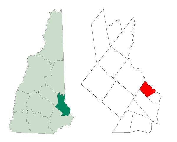
No higher resolution available.
Strafford-Somersworth-NH.png (600 × 481 pixels, file size: 11 KB, MIME type: image/png)
This is a file from the Wikimedia Commons and may be used by other projects. Information from its description page there is shown below. Commons is a freely licensed media file repository. |
| Description | Created from Boundary/Border Outline Files of the Libre Map Project which held a BY-SA creative commons license. Data origionally from 2000 US Census boundary data. |
| Date | |
| Source | Created from Boundary/Border Outline Files of the Libre Map Project which held a BY-SA creative commons license. Data origionally from 2000 US Census boundary data. |
| Author | Andrew Sawyer |
| Permission (Reusing this file) | Own work, attribution required (Multi-license with GFDL and Creative Commons CC-BY 2.5) |
I, the copyright holder of this work, hereby publish it under the following licenses:
 | Permission is granted to copy, distribute and/or modify this document under the terms of the GNU Free Documentation License, Version 1.2 or any later version published by the Free Software Foundation; with no Invariant Sections, no Front-Cover Texts, and no Back-Cover Texts. A copy of the license is included in the section entitled GNU Free Documentation License. |
| This file is licensed under the Creative Commons Attribution-Share Alike 3.0 Unported license. | ||
| ||
| This licensing tag was added to this file as part of the GFDL licensing update. |
This file is licensed under the Creative Commons Attribution 2.5 Generic license.
- You are free:
- to share – to copy, distribute and transmit the work
- to remix – to adapt the work
- Under the following conditions:
- attribution – You must give appropriate credit, provide a link to the license, and indicate if changes were made. You may do so in any reasonable manner, but not in any way that suggests the licensor endorses you or your use.
You may select the license of your choice.
File history
Click on a date/time to view the file as it appeared at that time.
| Date/Time | Thumbnail | Dimensions | User | Comment | |
|---|---|---|---|---|---|
| current | 18:43, 1 August 2006 | | 600 × 481 (11 KB) | Assawyer | {{Information| |Description=Created from [http://libre.redjar.org/maps/data/boundary/ Boundary/Border Outline Files] of the Libre Map Project which held a [http://creativecommons.org/licenses/by-sa/2.0/ BY-SA creative commons license]. Data origionally f |
File usage
There are no pages that use this file.
Global file usage
The following other wikis use this file:
- Usage on ar.wikipedia.org
- Usage on arz.wikipedia.org
- Usage on ca.wikipedia.org
- Usage on cy.wikipedia.org
- Usage on en.wikipedia.org
- Usage on eu.wikipedia.org
- Usage on fa.wikipedia.org
- Usage on fr.wikipedia.org
- Usage on glk.wikipedia.org
- Usage on ht.wikipedia.org
- Usage on it.wikipedia.org
- Usage on ja.wikipedia.org
- Usage on mzn.wikipedia.org
- Usage on pt.wikipedia.org
- Usage on sh.wikipedia.org
- Usage on sr.wikipedia.org
- Usage on sv.wikipedia.org
- Usage on tt.wikipedia.org
- Usage on ur.wikipedia.org
- Usage on vo.wikipedia.org
- Usage on www.wikidata.org
- Usage on zh.wikipedia.org
Explore the world

United states
New York

Japan
Tokyo

Singapore
Singapore
