
 Français
 Italiano
Size of this preview: 391 × 599 pixels. Other resolutions: 157 × 240 pixels | 313 × 480 pixels | 501 × 768 pixels | 1,200 × 1,838 pixels.
Original file (1,200 × 1,838 pixels, file size: 935 KB, MIME type: image/jpeg)
This is a file from the Wikimedia Commons and may be used by other projects. Information from its description page there is shown below. Commons is a freely licensed media file repository. |
Summary
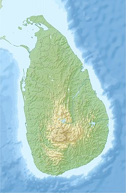
| Description | English: Location map of Sri Lanka. Equirectangular projection. Strechted by 101.0%. Geographic limits of the map: * N: 10.2° N * S: 5.5° N * W: 79.2° E * E: 82.3° EMade with Natural Earth. Free vector and raster map data @ naturalearthdata.com. |
| Date | |
| Source | Own work |
| Author | Uwe Dedering |
| Other versions |
|

Licensing
I, the copyright holder of this work, hereby publish it under the following licenses:
This file is licensed under the Creative Commons Attribution-Share Alike 3.0 Unported license.
- You are free:
- to share – to copy, distribute and transmit the work
- to remix – to adapt the work
- Under the following conditions:
- attribution – You must give appropriate credit, provide a link to the license, and indicate if changes were made. You may do so in any reasonable manner, but not in any way that suggests the licensor endorses you or your use.
- share alike – If you remix, transform, or build upon the material, you must distribute your contributions under the same or compatible license as the original.
 | Permission is granted to copy, distribute and/or modify this document under the terms of the GNU Free Documentation License, Version 1.2 or any later version published by the Free Software Foundation; with no Invariant Sections, no Front-Cover Texts, and no Back-Cover Texts. A copy of the license is included in the section entitled GNU Free Documentation License. |
You may select the license of your choice.
File history
Click on a date/time to view the file as it appeared at that time.
| Date/Time | Thumbnail | Dimensions | User | Comment | |
|---|---|---|---|---|---|
| current | 16:44, 3 July 2020 | | 1,200 × 1,838 (935 KB) | C1MM | Reverted to version as of 10:24, 24 April 2010 (UTC) |
| 05:43, 21 April 2020 |  | 1,200 × 1,838 (155 KB) | C1MM | More accurate STRM data | |
| 10:24, 24 April 2010 |  | 1,200 × 1,838 (935 KB) | Uwe Dedering | fixed opacity | |
| 10:07, 24 April 2010 |  | 1,200 × 1,838 (913 KB) | Uwe Dedering | {{Information |Description={{en|1=Location map of Sri Lanka. Equirectangular projection. Strechted by 101.0%. Geographic limits of the map: * N: 10.2° N * S: 5.5° N * W: 79.2° E * E: 82.3° E Made with Natural Earth. Free vector and raster map da |
File usage
There are no pages that use this file.
Global file usage
The following other wikis use this file:
- Usage on ar.wikipedia.org
- Usage on av.wikipedia.org
- Usage on az.wikipedia.org
- Usage on be.wikipedia.org
- Usage on bg.wikipedia.org
- Usage on bn.wikipedia.org
- Usage on bs.wikipedia.org
- Usage on ceb.wikipedia.org
- Usage on ce.wikipedia.org
- Usage on ckb.wikipedia.org
- Usage on cs.wikipedia.org
- Usage on de.wikipedia.org
- Usage on de.wikivoyage.org
View more global usage of this file.
Explore the world

United states
New York

Japan
Tokyo

Singapore
Singapore
