
 Français
 Italiano
Size of this PNG preview of this SVG file: 800 × 555 pixels. Other resolutions: 320 × 222 pixels | 640 × 444 pixels | 1,024 × 711 pixels | 1,280 × 888 pixels | 2,560 × 1,777 pixels | 1,265 × 878 pixels.
Original file (SVG file, nominally 1,265 × 878 pixels, file size: 1.22 MB)
This is a file from the Wikimedia Commons and may be used by other projects. Information from its description page there is shown below. Commons is a freely licensed media file repository. |
Summary
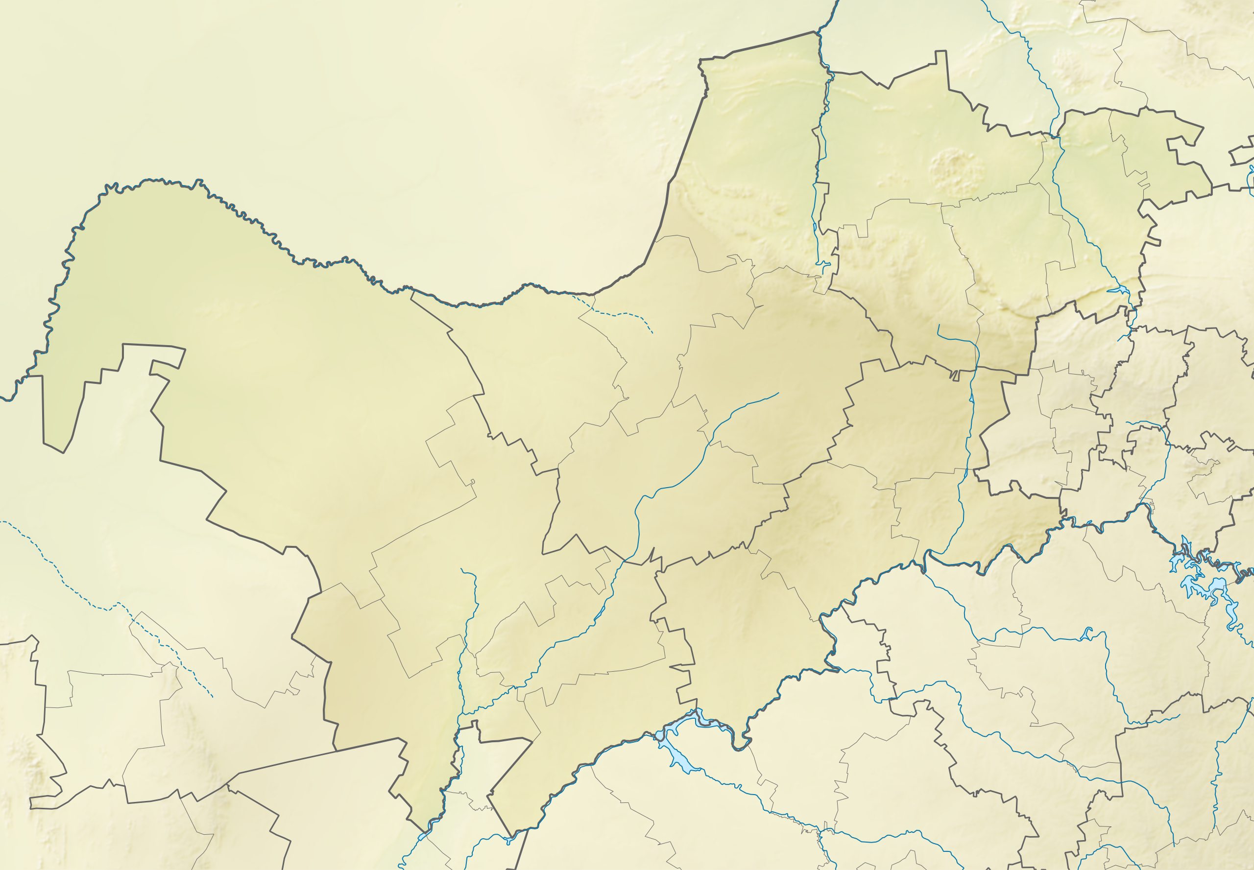
| Description | English: Relief location map of North West Equirectangular projection, N/S stretching 111%. Geographic limits of the map:
|
| Date | |
| Source | |
| Author | Htonl |
| Permission (Reusing this file) | I, the copyright holder of this work, hereby publish it under the following license: This file is licensed under the Creative Commons Attribution-Share Alike 3.0 Unported license.
|
| Other versions | File:South Africa North West location map.svg |
File history
Click on a date/time to view the file as it appeared at that time.
| Date/Time | Thumbnail | Dimensions | User | Comment | |
|---|---|---|---|---|---|
| current | 19:10, 6 January 2013 | | 1,265 × 878 (1.22 MB) | Htonl | == {{int:filedesc}} == {{Information |Description ={{en|Relief location map of en:North West (South African province) Equirectangular projection, N/S stretching 111%. Geographic limits of the map: * N: 24.5° S * S: 28.25° S * W: 22.5° E * E... |
File usage
There are no pages that use this file.
Global file usage
The following other wikis use this file:
- Usage on af.wikipedia.org
- Usage on ar.wikipedia.org
- Usage on bg.wikipedia.org
- Usage on ceb.wikipedia.org
- Usage on de.wikipedia.org
- Usage on en.wikipedia.org
- Pilanesberg International Airport
- Nedbank Golf Challenge
- Pilanesberg National Park
- Madikwe Game Reserve
- Royal Bafokeng Nation
- Dikhololo Game Reserve
- Mahikeng Airport
- Platinum Classic
- Nedbank Affinity Cup
- Borakalalo Game Reserve
- Mabalingwe Nature Reserve
- Bospoort Dam
- Module:Location map/data/South Africa North West/doc
- Rustenburg Airfield
- Leon Taljaard Nature Reserve
- Hartbeespoort Aerial Cableway
- Mafikeng Game Reserve
- Botsalano Game Reserve
- Investec Cup
- Magaliesberg Biosphere Reserve
- Module:Location map/data/South Africa North West
- Sun City Challenge
- SuperSport Ladies Challenge
- Sun International Ladies Challenge
- MyGolfLife Open
- Magaliesberg Protected Natural Environment
- Usage on eo.wikipedia.org
- Usage on es.wikipedia.org
- Usage on frr.wikipedia.org
- Usage on fr.wikipedia.org
- Usage on he.wikipedia.org
- Usage on incubator.wikimedia.org
View more global usage of this file.
Metadata
Explore the world

United states
New York

Japan
Tokyo

Singapore
Singapore
