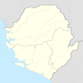
Size of this PNG preview of this SVG file: 600 × 600 pixels. Other resolutions: 240 × 240 pixels | 480 × 480 pixels | 768 × 768 pixels | 1,024 × 1,024 pixels | 2,048 × 2,048 pixels | 1,606 × 1,606 pixels.
Original file (SVG file, nominally 1,606 × 1,606 pixels, file size: 143 KB)
File history
Click on a date/time to view the file as it appeared at that time.
| Date/Time | Thumbnail | Dimensions | User | Comment | |
|---|---|---|---|---|---|
| current | 15:11, 19 January 2018 |  | 1,606 × 1,606 (143 KB) | NordNordWest | upd |
| 13:49, 30 November 2014 |  | 1,606 × 1,606 (142 KB) | NordNordWest | == {{int:filedesc}} == {{Information |Description= {{de|1=Positionskarte von Sierra Leone}} {{en|1=Location map of Sierra Leone}} {{Location map series N |stretching=100 |top=10.2 |bottom=6.8 |left=-13.5 |right=-10.1 }} |Source={{Own using}} * United S... |
File usage
There are no pages that use this file.
Global file usage
The following other wikis use this file:
- Usage on af.wikipedia.org
- Usage on ast.wikipedia.org
- Usage on azb.wikipedia.org
- Usage on bn.wikipedia.org
- Usage on de.wikipedia.org
- Freetown
- Banana Islands
- Kenema
- Bo (Sierra Leone)
- Loma Mountains
- Bunce Island
- Bintumani
- Makeni
- Sherbro (Insel)
- Koidu
- Kailahun
- Magburaka
- Bonthe
- Kabala
- Kambia
- Port Loko
- Pujehun
- Moyamba
- Lunsar
- Pandebu
- Waterloo (Sierra Leone)
- Ricketts Island
- Freetown International Airport
- Flugplatz Hastings
- Sulima (Sierra Leone)
- National-Stadion (Sierra Leone)
- Liste der Flughäfen in Sierra Leone
- Freetown Peninsula
- Yengema
- Vorlage:Positionskarte Sierra Leone
- Yele
- De-Ruyter-Stein
- Bastion des Fort Thornton
- Masakpaidu
- Tor zum alten Kings Yard
- Cleveland-Grabstein
- Treppen des alten Hafens und Wachhaus
- Mamamah International Airport
- Sonfon-See
View more global usage of this file.


 Français
 Italiano


