
 Français
 Italiano
Original file (SVG file, nominally 902 × 812 pixels, file size: 76 KB)
This is a file from the Wikimedia Commons and may be used by other projects. Information from its description page there is shown below. Commons is a freely licensed media file repository. |
Summary
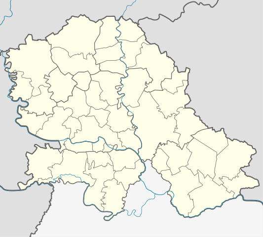
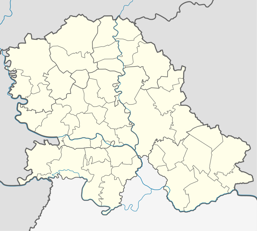
| Description | Quadratische Plattkarte, N-S-Streckung 140 %. Geographische Begrenzung der Karte:
Equirectangular projection, N/S stretching 140 %. Geographic limits of the map:
| |
| Date | ||
| Source | Own work using United States National Imagery and Mapping Agency data | |
| Author | NordNordWest | |
| Permission (Reusing this file) |
This file is licensed under the Creative Commons Attribution-Share Alike 3.0 Germany license.
 |

 | This map has been made or improved in the German Kartenwerkstatt (Map Lab). You can propose maps to improve as well. |
Licensing
- You are free:
- to share – to copy, distribute and transmit the work
- to remix – to adapt the work
- Under the following conditions:
- attribution – You must give appropriate credit, provide a link to the license, and indicate if changes were made. You may do so in any reasonable manner, but not in any way that suggests the licensor endorses you or your use.
- share alike – If you remix, transform, or build upon the material, you must distribute your contributions under the same or compatible license as the original.
File history
Click on a date/time to view the file as it appeared at that time.
| Date/Time | Thumbnail | Dimensions | User | Comment | |
|---|---|---|---|---|---|
| current | 19:53, 26 February 2013 | | 902 × 812 (76 KB) | NordNordWest | == {{int:filedesc}} == {{Information |Description= {{de|Positionskarte der Vojvodina, Serbien}} Quadratische Plattkarte, N-S-Streckung 140 %. Geographische Begrenzung der Karte: * N: 46.3° N * S: 44.5° N * W: 18.8° ... |
File usage
There are no pages that use this file.
Global file usage
The following other wikis use this file:
- Usage on ar.wikipedia.org
- Usage on ceb.wikipedia.org
- Usage on de.wikipedia.org
- Freiheitsbrücke (Novi Sad)
- Belo jezero
- Palić-See
- Wikipedia:Kartenwerkstatt/Positionskarten/Europa
- Iriški Venac
- Gudurički vrh
- Žeželjev most
- SPENS
- Stadion Karađorđe
- Kristall-Halle (Zrenjanin)
- Stadion Slavko Maletin Vava
- Vorlage:Positionskarte Serbien Vojvodina
- Smederevska Ada
- Jezero Joca
- Gradski stadion Inđija
- Usage on en.wikipedia.org
- Subotica
- Sombor
- Srpska Crnja
- Sremska Kamenica
- Futog
- Titel
- Mali Iđoš
- Veternik
- Jamena
- Manđelos
- Tovariševo
- Obrovac, Serbia
- Mladenovo
- Bočar
- Banatsko Novo Selo
- Kačarevo
- Bačko Dobro Polje
- Banatsko Aranđelovo
- Kelebija
- Palić
- Parage (Bačka Palanka)
- Pobeda (Bačka Topola)
- Panonija
- Kupusina
- Prigrevica
- Banatski Sokolac
- Donji Tavankut
- Aleksa Šantić (village)
- Bačko Petrovo Selo
- Nakovo
- Aradac
- Skorenovac
- Ledinci
View more global usage of this file.
Metadata
Explore the world

United states
New York

Japan
Tokyo

Singapore
Singapore
