
 Français
 Italiano
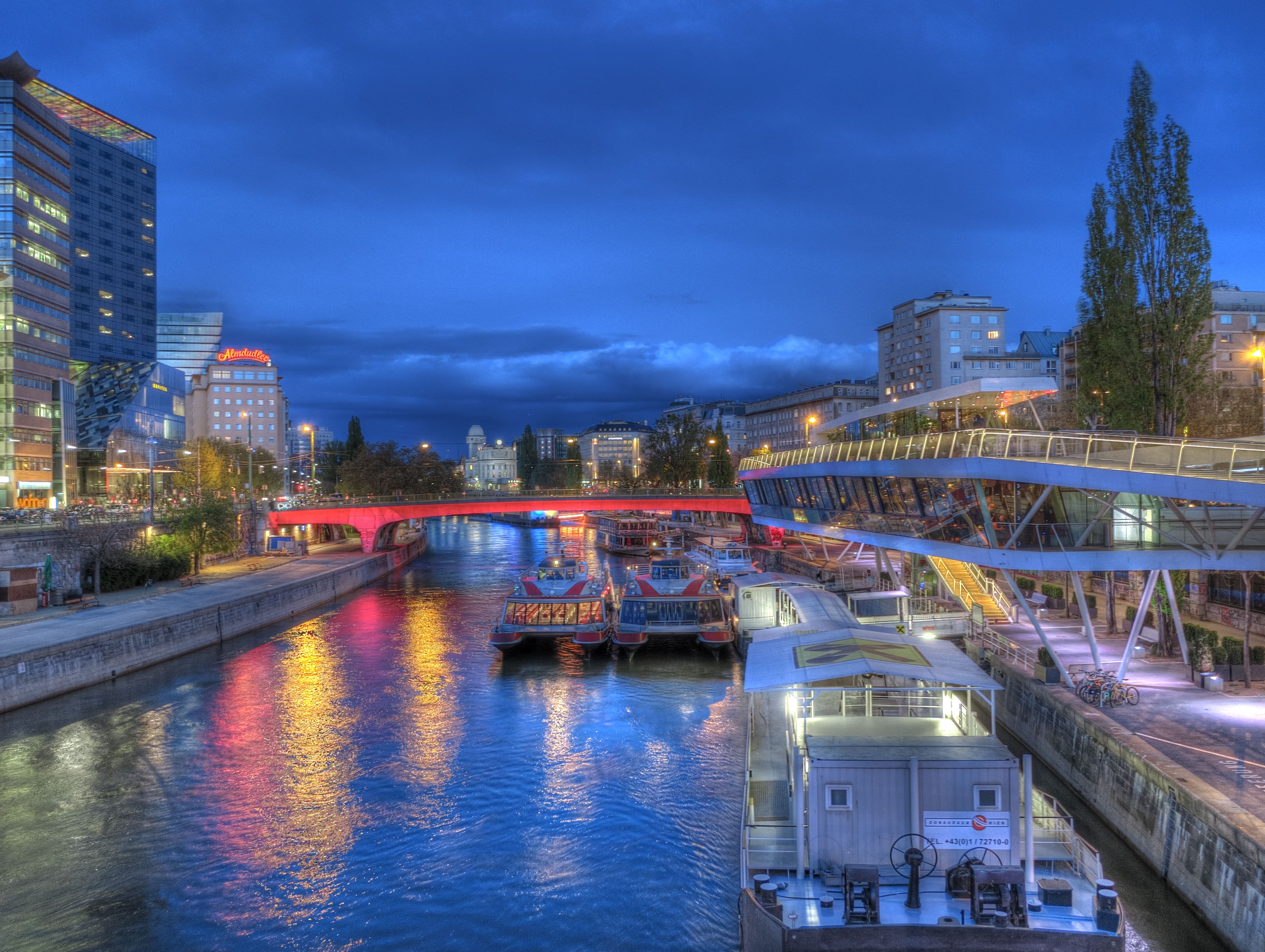
Size of this preview: 797 × 600 pixels. Other resolutions: 319 × 240 pixels | 638 × 480 pixels | 1,021 × 768 pixels | 1,280 × 963 pixels | 2,560 × 1,927 pixels | 4,326 × 3,256 pixels.
Original file (4,326 × 3,256 pixels, file size: 1.94 MB, MIME type: image/jpeg)
This is a file from the Wikimedia Commons and may be used by other projects. Information from its description page there is shown below. Commons is a freely licensed media file repository. |
Summary
| Description | Deutsch: Die abendlich rot beleuchtete Schwedenbrücke in Wien / Österreich / EU, gesehen von der flussaufwärts gelegenen Marienbrücke. Am linken Ufer der Beginn der Taborstraße im 2. Bezirk mit dem Sofitel Vienna. Etwas weiter hinten ein Haus mit einer roten "Almdudler" Leuchtreklame. Rechts die Haltestation der Twin City Liner (Schnellboot zwischen Wien und Bratislava) mit dem Lokal "Motto am Fluss". Hinten in der Mitte die Wiener Urania. Im nächtlichen Donaukanal spiegelt sich die rote Beleuchtung und der blaue, bewölkte Himmel. English: The evening red-lit Schweden-Bridge in Vienna / Austria / EU, as seen from the upstream Marien-Bridge seen. On the left bank of the beginning of the Tabor Road in the 2nd District with the Sofitel Vienna. A little later a house with a red "Almdudler" neon sign. Right to scuttle the Twin City Liner (speedboat between Vienna and Bratislava) with the local "Motto on the river." Back in the middle of the National Education Institute Urania. In the night Danube canal reflects the red light and blue, cloudy sky. | |
| Date | ||
| Source | Own work | |
| Author | Joadl | |
| Permission (Reusing this file) |
|
| Camera location | | View this and other nearby images on: OpenStreetMap |
|---|
| Object location | | View this and other nearby images on: OpenStreetMap |
|---|
| This is a retouched picture, which means that it has been digitally altered from its original version.
|
Licensing
I, the copyright holder of this work, hereby publish it under the following licenses:
 | Permission is granted to copy, distribute and/or modify this document under the terms of the GNU Free Documentation License, Version 1.2 or any later version published by the Free Software Foundation; with no Invariant Sections, no Front-Cover Texts, and no Back-Cover Texts. A copy of the license is included in the section entitled GNU Free Documentation License. |
This file is licensed under the Creative Commons Attribution-Share Alike 3.0 Austria license.
- You are free:
- to share – to copy, distribute and transmit the work
- to remix – to adapt the work
- Under the following conditions:
- attribution – You must give appropriate credit, provide a link to the license, and indicate if changes were made. You may do so in any reasonable manner, but not in any way that suggests the licensor endorses you or your use.
- share alike – If you remix, transform, or build upon the material, you must distribute your contributions under the same or compatible license as the original.

You may select the license of your choice.
File history
Click on a date/time to view the file as it appeared at that time.
| Date/Time | Thumbnail | Dimensions | User | Comment | |
|---|---|---|---|---|---|
| current | 20:28, 29 April 2012 | | 4,326 × 3,256 (1.94 MB) | Joadl | == {{int:filedesc}} == {{Information |Description= {{Multilingual description |de=Beschreibung folgt |en=comming soon}} |Source={{own}} |Date=2011-12-30 |Author=Joadl |Permission={{User:Joadl/Ref}} |other_versions= }} {{Location|46|41|40... |
File usage
The following 2 pages use this file:
Global file usage
The following other wikis use this file:
- Usage on bg.wikipedia.org
- Usage on bn.wikivoyage.org
- Usage on en.wikipedia.org
- Usage on eo.wikivoyage.org
- Usage on fr.wikipedia.org
- Usage on he.wikipedia.org
- Usage on incubator.wikimedia.org
- Usage on pl.wikivoyage.org
- Usage on pt.wikipedia.org
- Usage on uk.wikipedia.org
- Usage on zh.wikipedia.org
Metadata
Explore the world

United states
New York

Japan
Tokyo

Singapore
Singapore
