
 Français
 Italiano
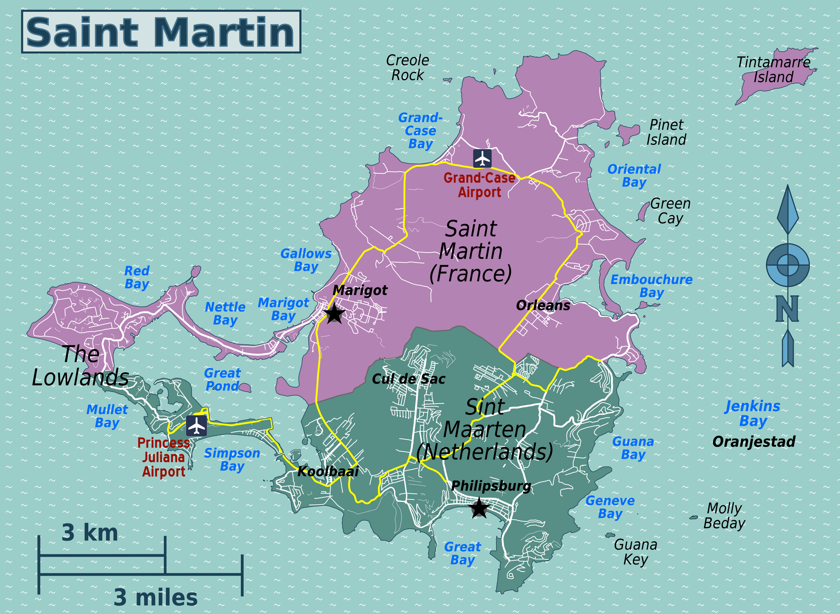
Size of this preview: 800 × 585 pixels. Other resolutions: 320 × 234 pixels | 640 × 468 pixels | 1,024 × 749 pixels | 1,280 × 936 pixels | 2,700 × 1,974 pixels.
Original file (2,700 × 1,974 pixels, file size: 1.29 MB, MIME type: image/png)
This is a file from the Wikimedia Commons and may be used by other projects. Information from its description page there is shown below. Commons is a freely licensed media file repository. |
| Description | English: Travel map of Saint Martin/Sint Maarten | |||
| Date | ||||
| Source | File:Various tiny Antilles travel maps.svg | |||
| Author | Peter Fitzgerald, OpenStreetMap | |||
| Permission (Reusing this file) | This file is licensed under the Creative Commons Attribution-Share Alike 2.0 Generic license.
|
File history
Click on a date/time to view the file as it appeared at that time.
| Date/Time | Thumbnail | Dimensions | User | Comment | |
|---|---|---|---|---|---|
| current | 17:30, 23 May 2013 | | 2,700 × 1,974 (1.29 MB) | Peterfitzgerald | +region names |
| 17:10, 23 May 2013 |  | 2,700 × 1,974 (1.25 MB) | Peterfitzgerald | {{Information |Description ={{en|1=Travel map of Saint Martin/Sint Maarten}} |Source =File:Various tiny Antilles travel maps.svg |Author =Peter Fitzgerald, [http://openstreetmap.org OpenStreetMap] |Date ... |
File usage
The following page uses this file:
Global file usage
The following other wikis use this file:
- Usage on cs.wikivoyage.org
- Usage on de.wikivoyage.org
- Usage on es.wikivoyage.org
- Usage on fr.wikivoyage.org
- Usage on he.wikivoyage.org
- Usage on it.wikivoyage.org
- Usage on zh.wikivoyage.org
Metadata
Explore the world

United states
New York

Japan
Tokyo

Singapore
Singapore
