
 Français
 Italiano
Size of this preview: 684 × 600 pixels. Other resolutions: 274 × 240 pixels | 547 × 480 pixels | 876 × 768 pixels | 1,168 × 1,024 pixels | 1,893 × 1,660 pixels.
Original file (1,893 × 1,660 pixels, file size: 1.7 MB, MIME type: image/jpeg)
This is a file from the Wikimedia Commons and may be used by other projects. Information from its description page there is shown below. Commons is a freely licensed media file repository. |
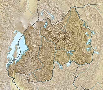
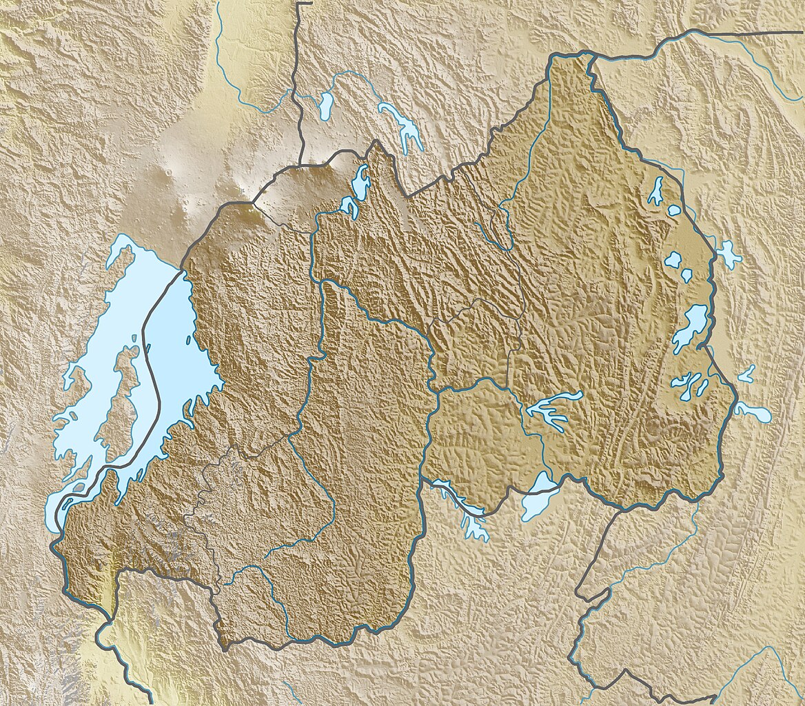
| Description | Deutsch: Physische Positionskarte von Ruanda Quadratische Plattkarte. Geographische Begrenzung der Karte:
English: Physical location map of Rwanda Equirectangular projection. Geographic limits of the map:
|
| Date | |
| Source | Own work, using map data from administrative map by NordNordWest. The relief was created from SRTM-3 relief data |
| Author | Carport |
| Permission (Reusing this file) | This file is licensed under the Creative Commons Attribution-Share Alike 3.0 Unported license.
|
| Other versions |
|

File history
Click on a date/time to view the file as it appeared at that time.
| Date/Time | Thumbnail | Dimensions | User | Comment | |
|---|---|---|---|---|---|
| current | 15:35, 26 March 2010 | | 1,893 × 1,660 (1.7 MB) | Carport | {{Information |Description={{de|Physische Positionskarte von {{w|Ruanda|3=de}}}} Quadratische Plattkarte. Geographische Begrenzung der Karte: * N: 0.9° S * S: 3.0° S * W: 28.7° O * O: 31.1° O {{en|Physical location map of {{w|Rwanda}}}} Equirectangula |
File usage
There are no pages that use this file.
Global file usage
The following other wikis use this file:
- Usage on ar.wikipedia.org
- Usage on ast.wikipedia.org
- Usage on az.wikipedia.org
- Usage on ban.wikipedia.org
- Usage on be.wikipedia.org
- Usage on bg.wikipedia.org
- Usage on bn.wikipedia.org
- Usage on bs.wikipedia.org
- Usage on ca.wikipedia.org
- Usage on ceb.wikipedia.org
- Usage on ce.wikipedia.org
- Usage on ckb.wikipedia.org
- Usage on cs.wikipedia.org
- Usage on da.wikipedia.org
- Usage on de.wikipedia.org
View more global usage of this file.
Metadata
Explore the world

United states
New York

Japan
Tokyo

Singapore
Singapore
