
 Français
 Italiano
Size of this preview: 750 × 600 pixels. Other resolutions: 300 × 240 pixels | 600 × 480 pixels | 960 × 768 pixels | 1,280 × 1,024 pixels | 1,700 × 1,360 pixels.
Original file (1,700 × 1,360 pixels, file size: 882 KB, MIME type: image/jpeg)
This is a file from the Wikimedia Commons and may be used by other projects. Information from its description page there is shown below. Commons is a freely licensed media file repository. |
Summary
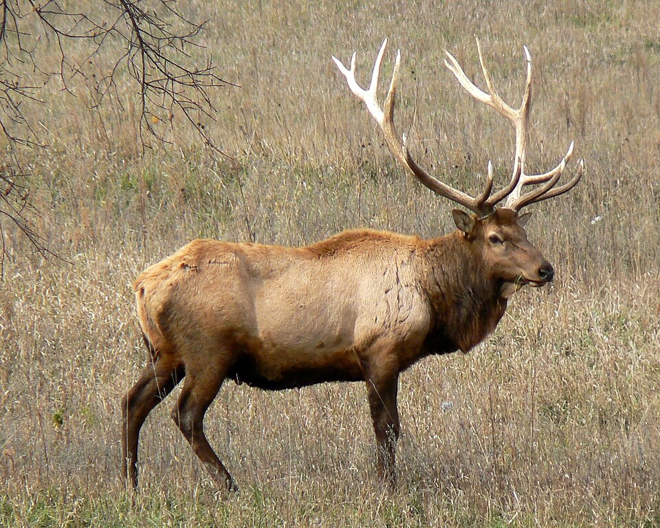
| Description | English: Rocky Mountain bull elk in Nebraska tall grass prairie |
| Date | |
| Source | Own work |
| Author | MONGO |
| Camera location | | View this and other nearby images on: OpenStreetMap |
|---|
Licensing
| I, the copyright holder of this work, release this work into the public domain. This applies worldwide. In some countries this may not be legally possible; if so: I grant anyone the right to use this work for any purpose, without any conditions, unless such conditions are required by law. |
File history
Click on a date/time to view the file as it appeared at that time.
| Date/Time | Thumbnail | Dimensions | User | Comment | |
|---|---|---|---|---|---|
| current | 23:24, 5 December 2010 | | 1,700 × 1,360 (882 KB) | MONGO | {{Information |Description={{en|1=Rocky Mountain bull elk in Nebraska tall grass prairie}} |Source={{own}} |Author=MONGO |Date= |Permission= |other_versions= }} Category:Cervus canadensis |
File usage
The following page uses this file:
Global file usage
The following other wikis use this file:
- Usage on af.wikipedia.org
- Usage on ar.wikipedia.org
- Usage on br.wiktionary.org
- Usage on ca.wikipedia.org
- Usage on ceb.wikipedia.org
- Usage on ckb.wikipedia.org
- Usage on da.wikipedia.org
- Usage on de.wikipedia.org
- Usage on el.wikipedia.org
- Usage on en.wikipedia.org
- Heber-Overgaard, Arizona
- List of domesticated animals
- List of U.S. state mammals
- List of European species extinct in the Holocene
- List of mammals of Florida
- Lee G. Simmons Conservation Park and Wildlife Safari
- List of mammals of Wyoming
- Outline of Grand Teton National Park
- List of fauna of Utah
- User:Leo1pard/sandbox/List of domesticated animals
- Largest cervids
- List of mammals of Utah
- Talk:Elk/Archive 4
- Usage on en.wiktionary.org
- Usage on es.wikipedia.org
- Usage on fa.wikipedia.org
- Usage on fi.wikipedia.org
- Usage on fr.wiktionary.org
- Usage on gd.wiktionary.org
- Usage on haw.wikipedia.org
- Usage on he.wikipedia.org
- Usage on hr.wikipedia.org
- Usage on hu.wikipedia.org
- Usage on incubator.wikimedia.org
- Usage on it.wikipedia.org
- Usage on ja.wikipedia.org
- Usage on jv.wikipedia.org
- Usage on la.wikipedia.org
- Usage on lv.wikipedia.org
- Usage on mk.wikipedia.org
- Usage on mn.wikipedia.org
- Usage on nl.wikipedia.org
- Usage on oc.wiktionary.org
View more global usage of this file.
Metadata
Explore the world

United states
New York

Japan
Tokyo

Singapore
Singapore
