Size of this preview: 711 × 600 pixels. Other resolutions: 285 × 240 pixels | 569 × 480 pixels | 911 × 768 pixels | 1,214 × 1,024 pixels | 2,429 × 2,048 pixels | 3,733 × 3,148 pixels.
Original file (3,733 × 3,148 pixels, file size: 6.6 MB, MIME type: image/png)
File history
Click on a date/time to view the file as it appeared at that time.
| Date/Time | Thumbnail | Dimensions | User | Comment | |
|---|---|---|---|---|---|
| current | 17:04, 26 December 2021 |  | 3,733 × 3,148 (6.6 MB) | Tschubby | {{Information |Description= |Source= |Date= |Author= |Permission= |other_versions= }} |
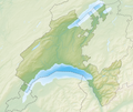
| 12:03, 6 December 2013 |  | 3,111 × 2,627 (7.38 MB) | Tschubby | {{Information |Description= {{de| Reliefkarte des Kantons Waadt}} Topographischer Hintergrund: [http://www2.jpl.nasa.gov/srtm NASA Shuttle Radar Topography Mission] (public domain). SRTM3 v.2. |Source={{own}} |Date= 2013-12-06 |Author= [[:de:User:Tschu... |
File usage
There are no pages that use this file.
Global file usage
The following other wikis use this file:
- Usage on bh.wikipedia.org
- Usage on de.wikipedia.org
- Schloss Chillon
- Chasseron
- La Dôle
- Mont Tendre
- Lac de Joux
- Lac Brenet
- Orbe (Fluss)
- Risoux
- Talent (Fluss)
- Col des Mosses
- Lac de l’Hongrin
- Col du Marchairuz
- Col de l’Aiguillon
- Col du Pillon
- Col du Mollendruz
- Col de la Givrine
- Col des Étroits
- Tour d’Aï
- HBG (Zeitzeichensender)
- Rochers de Naye
- Landessender Sottens
- Les Agites
- Mentue
- Petite Glâne
- Lembe (Fluss)
- Veyron (Fluss)
- Buron (Neuenburgersee)
- Sauteru
- Lac de Bret
- Mont Pèlerin
- Chandon (Fluss)
- Mormont (Berg)
- Dent de Vaulion
- Aiguilles de Baulmes
- Suchet (Berg)
- Mont Aubert
- Liste von Burgen und Schlössern in der Schweiz
- Noirmont (Berg)
- Crêt de la Neuve
- Les Pléiades
- Arrissoules-Tunnel
- Pomy-Tunnel
- Sender La Dôle
- Schloss Prangins
View more global usage of this file.


 Français
 Italiano


