
 Français
 Italiano
Size of this preview: 312 × 599 pixels. Other resolutions: 125 × 240 pixels | 250 × 480 pixels | 400 × 768 pixels | 533 × 1,024 pixels | 1,633 × 3,133 pixels.
Original file (1,633 × 3,133 pixels, file size: 6.87 MB, MIME type: image/png)
This is a file from the Wikimedia Commons and may be used by other projects. Information from its description page there is shown below. Commons is a freely licensed media file repository. |
Summary
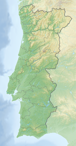
| Description | Deutsch: Reliefkarte Portugal Topographischer Hintergrund: NASA Shuttle Radar Topography Mission (public domain). SRTM3 v.2. | ||||||||
| Date | |||||||||
| Source | Own work | ||||||||
| Author | Tschubby | ||||||||
| Permission (Reusing this file) | I, the copyright holder of this work, hereby publish it under the following licenses:
This file is licensed under the Creative Commons Attribution-Share Alike 2.5 Generic, 2.0 Generic and 1.0 Generic license.
You may select the license of your choice. |

File history
Click on a date/time to view the file as it appeared at that time.
| Date/Time | Thumbnail | Dimensions | User | Comment | |
|---|---|---|---|---|---|
| current | 14:52, 12 March 2020 | | 1,633 × 3,133 (6.87 MB) | Tschubby | {{Information |description= |date= |source= |author= |permission= |other versions= }} |
| 17:31, 4 May 2018 |  | 1,633 × 3,132 (7.19 MB) | Tschubby | == {{int:filedesc}} == {{Information |Description= {{de| Reliefkarte Portugal}} Topographischer Hintergrund: [http://www2.jpl.nasa.gov/srtm NASA Shuttle Radar Topography Mission] (public domain). SRTM3 v.2. |Source={{own}} |Date= 2018-05-04 |Author= Tschubby |Permission= {{self|GFDL|Cc-by-sa-3.0-migrated|Cc-by-sa-2.5,2.0,1.0}} |other_versions= }} Category:Topographic maps of Portugal Category:Location maps of Portugal |
File usage
There are no pages that use this file.
Global file usage
The following other wikis use this file:
- Usage on bg.wikipedia.org
- Саброза
- Лисабон
- Порто
- Томар
- Порталегре
- Сакавен
- Ещорил
- Кашкайш
- Фатима (град)
- Овар
- Коимбра
- Гимараеш
- Трофа, Сегадайнш и Ламаш ду Вога
- Лейрия
- Треишедо
- Шаблон:ПК Португалия
- Порту Кову
- Авейро
- Тавира
- Фару
- Брага
- Вила Нова ди Гая
- Амадора
- Браганса
- Сетубал
- Вашку да Гама (мост)
- Сау Жуау ди Негрилюш
- Каминя
- Одимира
- Лоузан
- Матузинюш
- Леишоиш
- Монтижу
- Алкуентри
- Манастир на Баталя
- Кинта ду Анжу
- Кащру Верди
- Бежа
- Форнуш ди Алгодриш
- Повуа ди Варшин
- Барселуш
- Зезери
- Мондегу
- Сиера да Ищрела
- Фонти Лонга
- Санта Мария да Фейра
- Синтра
- Usage on ca.wikipedia.org
- Usage on da.wikipedia.org
View more global usage of this file.
Metadata
Explore the world

United states
New York

Japan
Tokyo

Singapore
Singapore
