
 Français
 Italiano
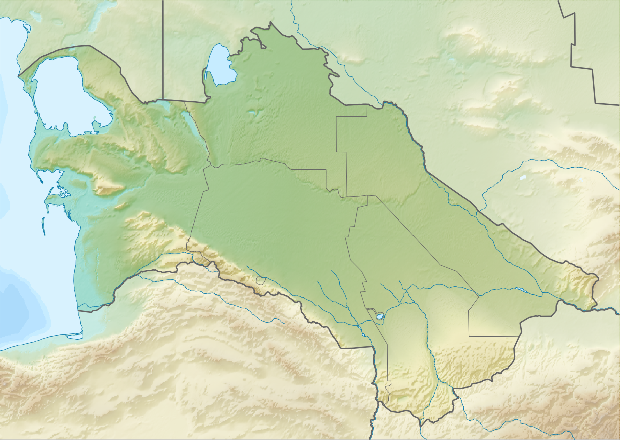
Size of this preview: 800 × 568 pixels. Other resolutions: 320 × 227 pixels | 640 × 454 pixels | 1,024 × 727 pixels | 1,237 × 878 pixels.
Original file (1,237 × 878 pixels, file size: 1.07 MB, MIME type: image/png)
This is a file from the Wikimedia Commons and may be used by other projects. Information from its description page there is shown below. Commons is a freely licensed media file repository. |
 | This map image could be re-created using vector graphics as an SVG file. This has several advantages; see Commons:Media for cleanup for more information. If an SVG form of this image is available, please upload it and afterwards replace this template with {{vector version available|new image name}}.It is recommended to name the SVG file “Relief Map of Turkmenistan.svg”—then the template Vector version available (or Vva) does not need the new image name parameter. |
Summary
| Description | English: Relief map of Turkmenistan Equirectangular projection, N/S stretching 130 %. Geographic limits of the map:
|
| Date | |
| Source | |
| Author |
|
| Permission (Reusing this file) | This file is licensed under the Creative Commons Attribution-Share Alike 3.0 Unported license.
|
File history
Click on a date/time to view the file as it appeared at that time.
| Date/Time | Thumbnail | Dimensions | User | Comment | |
|---|---|---|---|---|---|
| current | 13:14, 27 August 2010 | | 1,237 × 878 (1.07 MB) | Виктор В | == {{int:filedesc}} == {{Information |Description={{en|Relief map of Turkmenistan}} Equirectangular projection, N/S stretching 130 %. Geographic limits of the map: * N: 43.2° N * S: 34.9° N * W: 52.0° E * E: 67.2° E |Source=*[[:Fi |
File usage
There are no pages that use this file.
Global file usage
The following other wikis use this file:
- Usage on ar.wikipedia.org
- Usage on ast.wikipedia.org
- Usage on av.wikipedia.org
- Usage on azb.wikipedia.org
- Usage on az.wikipedia.org
- Şablon:Yer xəritəsi Türkmənistan
- Qaraqum səhrası
- Aşqabad zəlzələsi (1948)
- Kopetdağ
- Çələkən Oğurçalı boğazı
- Çələkən yarımadası
- Türkmənbaşı yarımadası
- Dərdcə yarımadası
- Oğurca
- Cənub-şərqi Qaraqum
- Sandıqlı çölü
- Zaunquz Qaraqumu
- Mərkəzi Qaraqum
- Sarıqamış gölü
- Altın əsr
- Qaraboğazgöl boğazı
- Baharlı mağarası
- Böyük oyun
- Usage on ba.wikipedia.org
- Usage on be-tarask.wikipedia.org
- Usage on be.wikipedia.org
- Usage on bg.wikipedia.org
View more global usage of this file.
Explore the world

United states
New York

Japan
Tokyo

Singapore
Singapore
