
 Français
 Italiano
Size of this preview: 800 × 600 pixels. Other resolutions: 320 × 240 pixels | 640 × 480 pixels | 1,024 × 768 pixels | 1,200 × 900 pixels.
Original file (1,200 × 900 pixels, file size: 387 KB, MIME type: image/jpeg)
This is a file from the Wikimedia Commons and may be used by other projects. Information from its description page there is shown below. Commons is a freely licensed media file repository. |
Summary
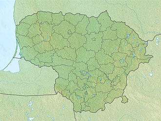
| Description | English: Location map of Lithuania Equirectangular projection, N/S stretching 170 %. Geographic limits of the map:
|
| Date | (UTC) |
| Source | |
| Author |
|
| This is a retouched picture, which means that it has been digitally altered from its original version. The original can be viewed here: Lithuania location map.svg:
|
Licensing
I, the copyright holder of this work, hereby publish it under the following licenses:
This file is licensed under the Creative Commons Attribution-Share Alike 3.0 Unported license.
- You are free:
- to share – to copy, distribute and transmit the work
- to remix – to adapt the work
- Under the following conditions:
- attribution – You must give appropriate credit, provide a link to the license, and indicate if changes were made. You may do so in any reasonable manner, but not in any way that suggests the licensor endorses you or your use.
- share alike – If you remix, transform, or build upon the material, you must distribute your contributions under the same or compatible license as the original.
 | Permission is granted to copy, distribute and/or modify this document under the terms of the GNU Free Documentation License, Version 1.2 or any later version published by the Free Software Foundation; with no Invariant Sections, no Front-Cover Texts, and no Back-Cover Texts. A copy of the license is included in the section entitled GNU Free Documentation License. |
You may select the license of your choice.
Original upload log
This image is a derivative work of the following images:
- File:Lithuania_location_map.svg licensed with Cc-by-sa-3.0, GFDL
- 2010-03-20T22:53:54Z NordNordWest 1095x821 (111884 Bytes) update
- 2008-08-29T08:11:36Z NordNordWest 1097x822 (103917 Bytes)
- 2008-07-02T15:27:16Z NordNordWest 548x411 (126294 Bytes) {{Information |Description= {{de|Positionskarte von [[:de:Litauen|Litauen]]}} Quadratische Plattkarte, N-S-Streckung 170 %. Geographische Begrenzung der Karte: * N: 56.7° N * S: 53.7° N * W: 20.4° O * O: 27.2° O {{en|Loca
Uploaded with derivativeFX
File history
Click on a date/time to view the file as it appeared at that time.
| Date/Time | Thumbnail | Dimensions | User | Comment | |
|---|---|---|---|---|---|
| current | 17:34, 27 November 2010 | | 1,200 × 900 (387 KB) | Виктор В | {{Information |Description={{en|Location map of Lithuania}} Equirectangular projection, N/S stretching 170 %. Geographic limits of the map: * N: 56.7° N * S: 53.7° N * W: 20.4° E * E: 27.2° E |Source=*[[:File:Lithuania_location_m |
File usage
There are no pages that use this file.
Global file usage
The following other wikis use this file:
- Usage on als.wikipedia.org
- Usage on an.wikipedia.org
- Usage on ar.wikipedia.org
- Usage on ast.wikipedia.org
- Usage on azb.wikipedia.org
- Usage on az.wikipedia.org
- Şablon:Yer xəritəsi Litva
- Aukştaytiya Milli Parkı
- Drukşyay gölü
- Platelyay gölü
- Klaypeda Dəmiryol Stansiyası
- Rusne adası
- İqnalina AES
- Kurş dili
- Vyante burnu
- Asveya gölü
- Çepkelyay
- Vilnüs Dəmiryolu Stansiyası
- Rambinas
- Labanoras Regional Parkı
- Tituvenay regional parkı
- Tauraqnas gölü
- Trakay Tarixi Milli Parkı
- Elektrenay su anbarı
- Dzukiya Milli Parkı
- Rekiva gölü
- Usage on ba.wikipedia.org
- Usage on be.wikipedia.org
View more global usage of this file.
Metadata
Explore the world

United states
New York

Japan
Tokyo

Singapore
Singapore
