
 Français
 Italiano
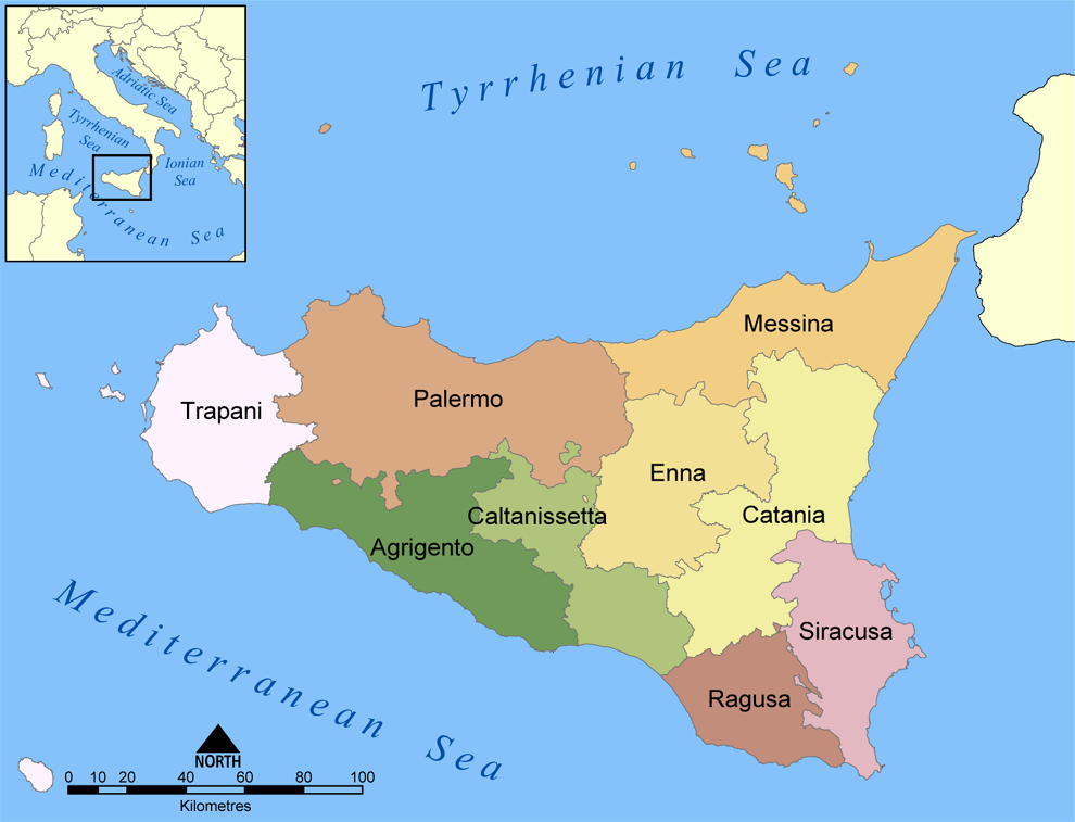
Size of this preview: 784 × 599 pixels. Other resolutions: 314 × 240 pixels | 628 × 480 pixels | 990 × 757 pixels.
Original file (990 × 757 pixels, file size: 183 KB, MIME type: image/png)
This is a file from the Wikimedia Commons and may be used by other projects. Information from its description page there is shown below. Commons is a freely licensed media file repository. |
 | File:Map of region of Sicily, Italy, with provinces-en.svg is a vector version of this file. It should be used in place of this PNG file when not inferior. File:Provinces of Sicily map.png → File:Map of region of Sicily, Italy, with provinces-en.svg For more information, see Help:SVG. |  |
This map shows the provinces of the Italian region of Sicily.
Blank version available at Image:Provinces of Sicily blank map.png.
Created by NormanEinstein, August 19, 2005.
I, the copyright holder of this work, hereby publish it under the following licenses:
 | Permission is granted to copy, distribute and/or modify this document under the terms of the GNU Free Documentation License, Version 1.2 or any later version published by the Free Software Foundation; with no Invariant Sections, no Front-Cover Texts, and no Back-Cover Texts. A copy of the license is included in the section entitled GNU Free Documentation License. |
| This file is licensed under the Creative Commons Attribution-Share Alike 3.0 Unported license. | ||
| ||
| This licensing tag was added to this file as part of the GFDL licensing update. |
You may select the license of your choice.
File history
Click on a date/time to view the file as it appeared at that time.
| Date/Time | Thumbnail | Dimensions | User | Comment | |
|---|---|---|---|---|---|
| current | 13:16, 11 August 2013 | | 990 × 757 (183 KB) | Ras67 | cropped and optimized |
| 20:00, 19 August 2005 |  | 1,000 × 769 (251 KB) | NormanEinstein | This map shows the provinces of the Italian region of Sicily. Created by NormanEinstein, August 19, 2005. {{GFDL-self}} Category:Maps of Italy |
File usage
There are no pages that use this file.
Global file usage
The following other wikis use this file:
- Usage on an.wikipedia.org
- Usage on ar.wikipedia.org
- Usage on ast.wikipedia.org
- Usage on br.wikipedia.org
- Usage on bs.wikipedia.org
- Usage on ca.wikipedia.org
- Usage on ceb.wikipedia.org
- Usage on de.wikipedia.org
- Usage on el.wikipedia.org
- Usage on en.wikipedia.org
- Usage on es.wikipedia.org
- Usage on es.wikiversity.org
- Usage on et.wikipedia.org
- Usage on eu.wikipedia.org
- Usage on fa.wikipedia.org
- Usage on fi.wikipedia.org
- Usage on fr.wikipedia.org
- Usage on gl.wikipedia.org
- Usage on hi.wikipedia.org
- Usage on hr.wikipedia.org
- Usage on hu.wikipedia.org
- Usage on hy.wikipedia.org
- Usage on id.wikipedia.org
View more global usage of this file.
Metadata
Explore the world

United states
New York

Japan
Tokyo

Singapore
Singapore
