
 Français
 Italiano
Size of this preview: 569 × 600 pixels. Other resolutions: 228 × 240 pixels | 455 × 480 pixels | 728 × 768 pixels | 971 × 1,024 pixels | 1,456 × 1,535 pixels.
Original file (1,456 × 1,535 pixels, file size: 332 KB, MIME type: image/png)
This is a file from the Wikimedia Commons and may be used by other projects. Information from its description page there is shown below. Commons is a freely licensed media file repository. |
 | File:Proposed states and union territories of India.svg is a vector version of this file. It should be used in place of this PNG file when not inferior. File:Proposed states and territories of India.png → File:Proposed states and union territories of India.svg For more information, see Help:SVG. |  |
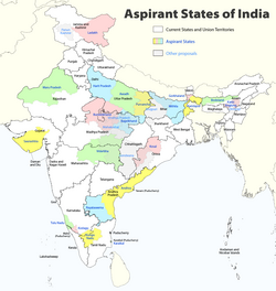
| Description | Deutsch: Indiens Anwärterstaaten English: Aspirant States of India |
| Date | |
| Source | Own work |
| Author | Maximilian Dörrbecker (Chumwa) |
| Permission (Reusing this file) | I, the copyright holder of this work, hereby publish it under the following license: This file is licensed under the Creative Commons Attribution-Share Alike 2.5 Generic license.
Sie dürfen das Bild zu den folgenden Bedingungen nutzen:
|
| Other versions | |

File history
Click on a date/time to view the file as it appeared at that time.
| Date/Time | Thumbnail | Dimensions | User | Comment | |
|---|---|---|---|---|---|
| current | 09:06, 2 August 2020 | | 1,456 × 1,535 (332 KB) | Chumwa | Reverted to version as of 21:03, 29 August 2018 (UTC) |
| 20:03, 30 July 2020 |  | 1,456 × 1,535 (316 KB) | UT'sIndia | Reverted to version as of 15:15, 17 May 2013 (UTC) | |
| 21:03, 29 August 2018 |  | 1,456 × 1,535 (332 KB) | Chumwa | extended Tulu Nadu into Kerala | |
| 21:52, 5 June 2014 |  | 1,456 × 1,535 (332 KB) | Chumwa | borders of Rayalseema corrected | |
| 18:23, 3 June 2014 |  | 1,456 × 1,535 (332 KB) | Chumwa | borders of Mithila corrected | |
| 17:53, 3 June 2014 |  | 1,456 × 1,535 (331 KB) | Chumwa | Telangana now is an official state | |
| 15:16, 17 May 2013 |  | 1,456 × 1,535 (316 KB) | Cromium | Removed large title; enlarged map key with slightly different wording | |
| 15:15, 17 May 2013 |  | 1,456 × 1,535 (316 KB) | Cromium | Removed large title; enlarged map key with slightly different wording | |
| 22:32, 2 January 2012 |  | 1,456 × 1,535 (312 KB) | Chumwa | added some other aspirant states | |
| 21:16, 2 January 2012 |  | 1,456 × 1,535 (292 KB) | Chumwa | added a map key |
File usage
There are no pages that use this file.
Global file usage
The following other wikis use this file:
- Usage on bn.wikipedia.org
- Usage on de.wikipedia.org
- Usage on en.wikipedia.org
- Delhi
- Gondwana (India)
- Kodagu district
- Mithila (proposed Indian state)
- Awadh
- Vidarbha
- Bundelkhand
- Bagelkhand
- Tulu Nadu
- Rayalaseema
- Purvanchal
- Bodoland Territorial Region
- Karbi Anglong district
- Mahakoshal
- Kongu Nadu
- Cooch Behar district
- Gird, India
- Mara Autonomous District Council
- Tripura Tribal Areas Autonomous District Council
- Malabar District
- Gorkhaland movement
- Kamtapur
- Proposed states and union territories of India
- Autonomous administrative divisions of India
- Karaikal district
- Panun Kashmir
- Chakma Autonomous District Council
- Lai Autonomous District Council
- Khasi Hills Autonomous District Council
- Jaintia Hills Autonomous District Council
- Garo Hills Autonomous District Council
- Template:Proposed states and union territories of India
- Tulu Nadu state movement
- Kosal state movement
- User:AbhisheksinghWIKI/Law and Order(India)
- Gorkhaland Territorial Administration
- Tipraland
- Kalyana-Karnataka
- Sadar Hills
- West Karbi Anglong district
View more global usage of this file.
Metadata
Explore the world

United states
New York

Japan
Tokyo

Singapore
Singapore
