Size of this preview: 706 × 599 pixels. Other resolutions: 283 × 240 pixels | 566 × 480 pixels.
Original file (800 × 679 pixels, file size: 92 KB, MIME type: image/png)
File history
Click on a date/time to view the file as it appeared at that time.
| Date/Time | Thumbnail | Dimensions | User | Comment | |
|---|---|---|---|---|---|
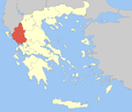
| current | 11:47, 5 April 2008 |  | 800 × 679 (92 KB) | Pitichinaccio | {{Information |Description=Locator Map of Epirus Periphery, Greece |Source=eigene Arbeit |Date=April 5, 2008 |Author= Pitichinaccio }} {{PD-self}} Category:Periphery maps of Greece |
File usage
There are no pages that use this file.
Global file usage
The following other wikis use this file:
- Usage on ay.wikipedia.org
- Usage on ceb.wikipedia.org
- Usage on da.wikipedia.org
- Usage on de.wikipedia.org
- Usage on el.wikipedia.org
- Usage on en.wikipedia.org
- Dodoni
- Arta (regional unit)
- Ioannina
- Preveza
- Thesprotia
- Metsovo
- Konitsa
- Parga
- Zagori
- Souli
- Ioannina (regional unit)
- Preveza (regional unit)
- Arta, Greece
- Igoumenitsa
- Epirus (region)
- Georgios Karaiskakis (municipality)
- Filiates
- Zitsa
- Template:Epirus Region
- North Tzoumerka
- Pogoni
- Central Tzoumerka
- Nikolaos Skoufas (municipality)
- Ziros, Preveza
- Usage on fa.wikipedia.org
- Usage on fr.wikipedia.org
View more global usage of this file.


 Français
 Italiano


