
 Français
 Italiano
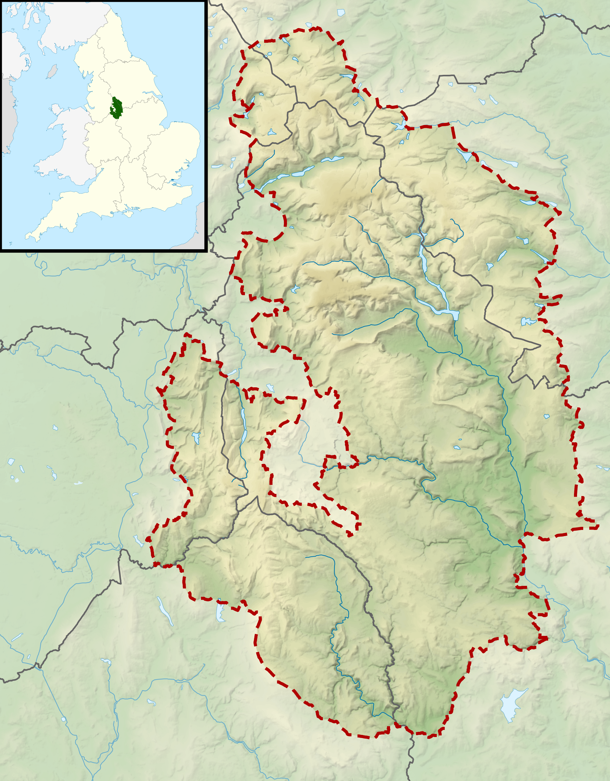
Size of this preview: 469 × 600 pixels. Other resolutions: 188 × 240 pixels | 375 × 480 pixels | 601 × 768 pixels | 801 × 1,024 pixels | 2,000 × 2,557 pixels.
Original file (2,000 × 2,557 pixels, file size: 3.32 MB, MIME type: image/png)
This is a file from the Wikimedia Commons and may be used by other projects. Information from its description page there is shown below. Commons is a freely licensed media file repository. |
| Description | Relief map of the Peak District National Park, UK Equirectangular map projection on WGS 84 datum, with N/S stretched 170% Geographic limits:
|
| Date | |
| Source | Office of National Statistics Geography
|
| Author | Nilfanion, created using Ordnance Survey data |
| Permission (Reusing this file) | This file is licensed under the Creative Commons Attribution-Share Alike 3.0 Unported license. Attribution: Contains Ordnance Survey data © Crown copyright and database right
|
File history
Click on a date/time to view the file as it appeared at that time.
| Date/Time | Thumbnail | Dimensions | User | Comment | |
|---|---|---|---|---|---|
| current | 10:58, 17 March 2012 | | 2,000 × 2,557 (3.32 MB) | Nilfanion | {{Information |Description=Relief map of the Peak District National Park, UK Equirectangular map projection on WGS 84 datum, with N/S stretched 170% Geographic limits: *West: 2.30W *East: 1.50W *North: 53.62N *South: 53.00N |Sourc... |
File usage
There are no pages that use this file.
Global file usage
The following other wikis use this file:
- Usage on en.wikipedia.org
- Mam Tor
- Kinder Scout
- Bleaklow
- Black Hill (Peak District)
- Thorpe Cloud
- Shining Tor
- Merryton Low
- Axe Edge Moor
- Derwent Edge
- Margery Hill
- Black Chew Head
- Cheeks Hill
- Higger Tor
- Rushup Edge
- Brown Knoll
- Featherbed Moss
- Featherbed Top
- Mill Hill (Derbyshire)
- Britland Edge Hill
- Lost Lad
- Oliver Hill (Peak District)
- Black Edge
- Grin Low
- Module:Location map/data/United Kingdom Peak District
- Module:Location map/data/United Kingdom Peak District/doc
Metadata
Explore the world

United states
New York

Japan
Tokyo

Singapore
Singapore
