
 Français
 Italiano
Size of this preview: 800 × 589 pixels. Other resolutions: 320 × 236 pixels | 640 × 471 pixels | 1,024 × 754 pixels | 1,280 × 942 pixels | 2,623 × 1,931 pixels.
Original file (2,623 × 1,931 pixels, file size: 499 KB, MIME type: image/jpeg)
This is a file from the Wikimedia Commons and may be used by other projects. Information from its description page there is shown below. Commons is a freely licensed media file repository. |
Summary
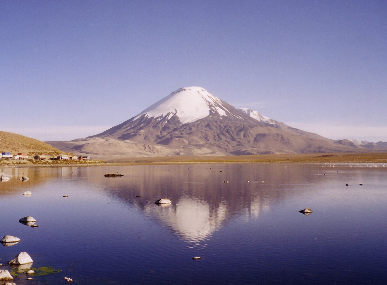
| Description | Parinacota and Laguna Chungara |
| Date | |
| Source | Own work |
| Author | Gerd Breitenbach |
Licensing
 | Permission is granted to copy, distribute and/or modify this document under the terms of the GNU Free Documentation License, Version 1.2 or any later version published by the Free Software Foundation; with no Invariant Sections, no Front-Cover Texts, and no Back-Cover Texts. A copy of the license is included in the section entitled GNU Free Documentation License. |
| This file is licensed under the Creative Commons Attribution-Share Alike 3.0 Unported license. | ||
| ||
| This licensing tag was added to this file as part of the GFDL licensing update. |
File history
Click on a date/time to view the file as it appeared at that time.
| Date/Time | Thumbnail | Dimensions | User | Comment | |
|---|---|---|---|---|---|
| current | 15:50, 11 May 2005 | | 2,623 × 1,931 (499 KB) | Gerd Breitenbach | Parinacota and Laguna Chungara, own fotography 2003 {{GFDL}} |
File usage
The following 2 pages use this file:
Global file usage
The following other wikis use this file:
- Usage on ar.wikipedia.org
- Usage on arz.wikipedia.org
- Usage on ay.wikipedia.org
- Usage on az.wikipedia.org
- Usage on be-tarask.wikipedia.org
- Usage on be.wikipedia.org
- Usage on bn.wikipedia.org
- Usage on br.wikipedia.org
- Usage on ca.wikipedia.org
- Usage on ceb.wikipedia.org
- Usage on ckb.wikipedia.org
- Usage on cs.wikipedia.org
- Usage on da.wikipedia.org
- Usage on de.wikipedia.org
- Usage on de.wikivoyage.org
- Usage on diq.wikipedia.org
- Usage on en.wikipedia.org
- Arica
- Morro de Arica
- Acotango
- Pomerape
- Payachata
- Kimsa Chata (Bolivia-Chile)
- Cordillera Occidental (Central Andes)
- Visviri
- Lauca
- Salar de Surire Natural Monument
- Wikipedia:WikiProject Lakes/Galleries/4
- Las Vicuñas National Reserve
- Codpa
- Water resources
- Template:AricaParinacota-geo-stub
- Cosapilla River
- Cerro Cosapilla
- Ancuta
View more global usage of this file.
Metadata
Explore the world

United states
New York

Japan
Tokyo

Singapore
Singapore
