
 Français
 Italiano
Size of this preview: 800 × 485 pixels. Other resolutions: 320 × 194 pixels | 640 × 388 pixels | 1,024 × 620 pixels | 1,280 × 776 pixels | 2,560 × 1,551 pixels | 5,998 × 3,634 pixels.
Original file (5,998 × 3,634 pixels, file size: 14.96 MB, MIME type: image/jpeg)
This is a file from the Wikimedia Commons and may be used by other projects. Information from its description page there is shown below. Commons is a freely licensed media file repository. |
Summary
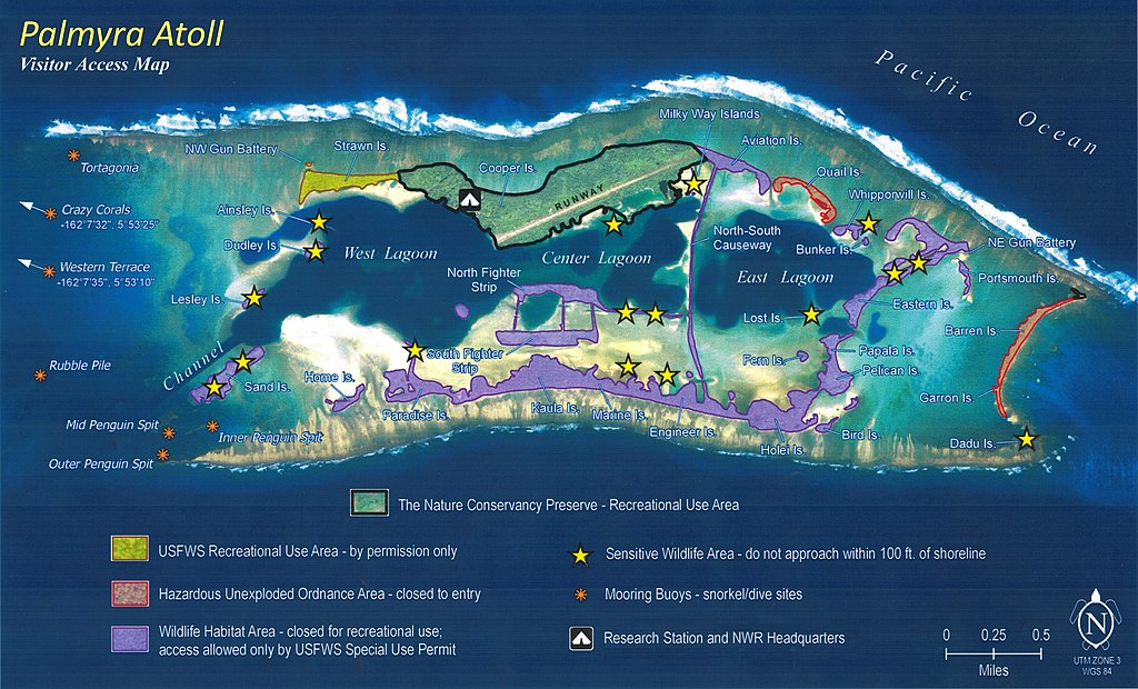
| Description | English: Map of accessible and restricted areas at Palmyra Atoll National Wildlife Refuge |
| Date | |
| Source | United States Fish and Wildlife Service |
| Author | United States Fish and Wildlife Service |
| Camera location | | View this and other nearby images on: OpenStreetMap |
|---|
Licensing
This image or recording is the work of a U.S. Fish and Wildlife Service employee, taken or made as part of that person's official duties. As a work of the U.S. federal government, the image is in the public domain. For more information, see the Fish and Wildlife Service copyright policy.
|  |
File history
Click on a date/time to view the file as it appeared at that time.
| Date/Time | Thumbnail | Dimensions | User | Comment | |
|---|---|---|---|---|---|
| current | 21:18, 5 January 2016 | | 5,998 × 3,634 (14.96 MB) | Surfsupusa | User created page with UploadWizard |
File usage
The following page uses this file:
Global file usage
The following other wikis use this file:
- Usage on bg.wikipedia.org
- Usage on en.wikipedia.org
- Usage on es.wikivoyage.org
- Usage on hr.wikipedia.org
- Usage on zh.wikipedia.org
Metadata
Explore the world

United states
New York

Japan
Tokyo

Singapore
Singapore
