
 Français
 Italiano
Size of this PNG preview of this SVG file: 640 × 536 pixels. Other resolutions: 287 × 240 pixels | 917 × 768 pixels | 1,223 × 1,024 pixels | 2,445 × 2,048 pixels.
Original file (SVG file, nominally 640 × 536 pixels, file size: 11 KB)
This is a file from the Wikimedia Commons and may be used by other projects. Information from its description page there is shown below. Commons is a freely licensed media file repository. |
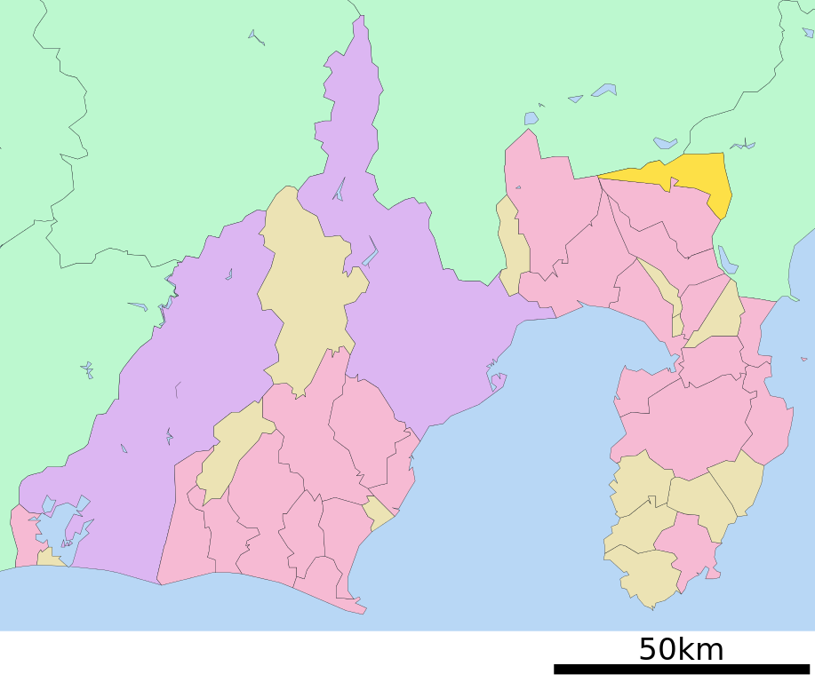
| Description | 日本語: 日本国・静岡県駿東郡小山町の位置 English: The location of Oyama town Shizuoka prefecture Japan | ||||||||
| Date | Uploaded by Lincun to Japanese Wikipedia in January 4th 2009. | ||||||||
| Source | File:基礎自治体位置図 22344.svg on Japanese Wikipedia | ||||||||
| Author | Lincun | ||||||||
| Permission (Reusing this file) |
|

derivative works
Derivative works of this file: Flag map of Shizuoka Prefecture.svg
File history
Click on a date/time to view the file as it appeared at that time.
| Date/Time | Thumbnail | Dimensions | User | Comment | |
|---|---|---|---|---|---|
| current | 07:57, 31 October 2009 | | 640 × 536 (11 KB) | Monaneko | red -> yellow |
| 09:15, 29 June 2009 |  | 640 × 536 (11 KB) | LERK | uploaded the latest version of ja:ファイル:基礎自治体位置図 22344.svg on jawp and edited | |
| 15:27, 4 August 2007 |  | 803 × 620 (22 KB) | Yuriybrisk | {{Information |Description=Oyama-chō Shizuoka-ken Japan. SVG Version=0.8.2441.19265 |Source= From Japanese Wikipedia http://ja.wikipedia.org/wiki/%E7%94%BB%E5%83%8F:%E9%9D%99%E5%B2%A1%E7%9C%8C%E5%B0%8F%E5%B1%B1%E7%94%BA%E7%9C%8C%E5%86 |
File usage
There are no pages that use this file.
Global file usage
The following other wikis use this file:
- Usage on ar.wikipedia.org
- Usage on arz.wikipedia.org
- Usage on es.wikipedia.org
- Usage on fa.wikipedia.org
- Usage on fr.wikipedia.org
- Usage on it.wikipedia.org
- Usage on ko.wikipedia.org
- Usage on ro.wikipedia.org
- Usage on uk.wikipedia.org
- Usage on www.wikidata.org
Metadata
Explore the world

United states
New York

Japan
Tokyo

Singapore
Singapore
