
 Français
 Italiano
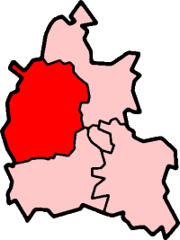
No higher resolution available.
OxfordshireWest.png (200 × 267 pixels, file size: 11 KB, MIME type: image/png)
This is a file from the Wikimedia Commons and may be used by other projects. Information from its description page there is shown below. Commons is a freely licensed media file repository. |
West Oxfordshire in Oxfordshire
Created by en:User:Morwen
 | Permission is granted to copy, distribute and/or modify this document under the terms of the GNU Free Documentation License, Version 1.2 or any later version published by the Free Software Foundation; with no Invariant Sections, no Front-Cover Texts, and no Back-Cover Texts. A copy of the license is included in the section entitled GNU Free Documentation License. |
| This file is licensed under the Creative Commons Attribution-Share Alike 3.0 Unported license. | ||
| ||
| This licensing tag was added to this file as part of the GFDL licensing update. |
File history
Click on a date/time to view the file as it appeared at that time.
| Date/Time | Thumbnail | Dimensions | User | Comment | |
|---|---|---|---|---|---|
| current | 13:11, 29 October 2011 | | 200 × 267 (11 KB) | Mahahahaneapneap | Transparent background |
| 17:42, 30 July 2005 |  | 200 × 267 (17 KB) | Cnyborg | West Oxfordshire in Oxfordshire, England. From en:Image:OxfordshireWest.png by en:User:Morwen {{GFDL-en}} Category:Maps of English districts |
File usage
There are no pages that use this file.
Global file usage
The following other wikis use this file:
- Usage on de.wikipedia.org
- Usage on en.wikipedia.org
- Blenheim Palace
- Witney
- Burford
- West Oxfordshire
- Spelsbury
- Charlbury
- Taston
- Carterton, Oxfordshire
- Chipping Norton
- Woodstock, Oxfordshire
- Chadlington
- Eynsham
- Kelmscott
- Combe, Oxfordshire
- Stonesfield
- Churchill, Oxfordshire
- Kingham
- Henley (UK Parliament constituency)
- Banbury (UK Parliament constituency)
- Witney (UK Parliament constituency)
- Wychwood
- Radford, Oxfordshire
- Tackley
- Brize Norton
- Curbridge, Oxfordshire
- Ducklington
- Shilton, Oxfordshire
- Alvescot
- Ascott-under-Wychwood
- Asthall
- Aston, Cote, Shifford and Chimney
- Bampton, Oxfordshire
- Long Hanborough
- Black Bourton
- Bladon
- Blenheim, Oxfordshire
- Broadwell, Oxfordshire
- Bruern
- Standlake
- Milton-under-Wychwood
- Shipton-under-Wychwood
- Swinbrook
- Enstone
- Cogges
- Leafield
- Salford, Oxfordshire
- Minster Lovell
- Chastleton
- Yelford
View more global usage of this file.
Metadata
Explore the world

United states
New York

Japan
Tokyo

Singapore
Singapore
