
 Français
 Italiano
Size of this preview: 467 × 599 pixels. Other resolutions: 187 × 240 pixels | 374 × 480 pixels | 598 × 768 pixels | 798 × 1,024 pixels | 2,004 × 2,572 pixels.
Original file (2,004 × 2,572 pixels, file size: 357 KB, MIME type: image/jpeg)
This is a file from the Wikimedia Commons and may be used by other projects. Information from its description page there is shown below. Commons is a freely licensed media file repository. |
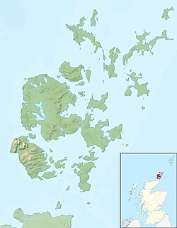
| Description | Relief map of the Orkney Islands (excluding Sule Stack and Sule Skerry), UK. Equirectangular map projection on WGS 84 datum, with N/S stretched 180% Geographic limits:
|
| Date | |
| Source |
|
| Author | Nilfanion, created using Ordnance Survey data |
| Permission (Reusing this file) | This file is licensed under the Creative Commons Attribution-Share Alike 3.0 Unported license. Attribution: Contains Ordnance Survey data © Crown copyright and database right
|
| Other versions | File:Orkney Islands UK blank map.svg - Blank map |
File history
Click on a date/time to view the file as it appeared at that time.
| Date/Time | Thumbnail | Dimensions | User | Comment | |
|---|---|---|---|---|---|
| current | 12:26, 30 November 2011 | | 2,004 × 2,572 (357 KB) | Nilfanion | {{Information |Description=Relief map of the Orkney Islands (excluding Sule Stack and Sule Skerry), UK. Equirectangular map projection on WGS 84 datum, with N/S stretched 180% Geographic limits: *W |
File usage
There are no pages that use this file.
Global file usage
The following other wikis use this file:
- Usage on ar.wikipedia.org
- Usage on bg.wikipedia.org
- Usage on ceb.wikipedia.org
- Usage on de.wikipedia.org
- Scapa Flow
- Bootsgrab von Scar
- Inganess Bay
- Westray Stone
- Taversoe Tuick
- Yetnasteen
- Sule Stack
- Blackhammer
- Broch von Windwick
- Knowes o’ Trotty
- Damsay
- Wideford Hill Cairn
- Vorlage:Positionskarte Schottland Orkney
- Benutzer:Metilsteiner/KARTENDIENSTE
- Loch of Stenness
- Loch of Harray
- Souterrain von Windwick
- Ness of Brodgar
- Benutzer Diskussion:Thgoiter/Archiv/2013
- Gräberfeld von Westness
- Benutzer Diskussion:Metilsteiner/Archiv/2013/April
- Muckle Skerry (Orkney)
- Kili Holm
- Kirkwall Castle
- Menhire von Stanerandy
- Holm of Grimbister
- Usage on el.wikipedia.org
- Usage on en.wikipedia.org
View more global usage of this file.
Explore the world

United states
New York

Japan
Tokyo

Singapore
Singapore
