
 Français
 Italiano
Size of this preview: 800 × 588 pixels. Other resolutions: 320 × 235 pixels | 640 × 470 pixels | 906 × 666 pixels.
Original file (906 × 666 pixels, file size: 16 KB, MIME type: image/gif, 0.1 s)
This is a file from the Wikimedia Commons and may be used by other projects. Information from its description page there is shown below. Commons is a freely licensed media file repository. |
Summary
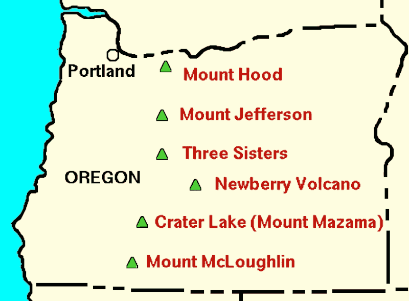
| Description | English: Cropped version of USGS Cascades volcanoes map, showing just the major volcanoes in Oregon |
| Date | (UTC) |
| Source | This file was derived from: Oregon volcanoes map.png: |
| Author |
|
Licensing
This image is in the public domain in the United States because it only contains materials that originally came from the United States Geological Survey, an agency of the United States Department of the Interior. For more information, see the official USGS copyright policy.
|
Cropping, AI upscaling:
| This file is made available under the Creative Commons CC0 1.0 Universal Public Domain Dedication. | |
| The person who associated a work with this deed has dedicated the work to the public domain by waiving all of their rights to the work worldwide under copyright law, including all related and neighboring rights, to the extent allowed by law. You can copy, modify, distribute and perform the work, even for commercial purposes, all without asking permission.
|
Original upload log
This image is a derivative work of the following images:
- File:Oregon volcanoes map.png licensed with Cc-zero, PD-USGov-USGS
- 2017-11-25T05:33:48Z Hike395 453x333 (4437 Bytes) {{Information |Description ={{en|1=Cropped version of USGS Cascades volcanoes map, showing just the major volcanoes in Oregon}} |Source =[http://web.archive.org/web/20050311033837/http://vulcan.wr.usgs.gov/Volcanoe
Uploaded with derivativeFX
File history
Click on a date/time to view the file as it appeared at that time.
| Date/Time | Thumbnail | Dimensions | User | Comment | |
|---|---|---|---|---|---|
| current | 19:55, 21 September 2023 | | 906 × 666 (16 KB) | Hike395 | == {{int:filedesc}} == {{Information |Description={{en|1=Cropped version of USGS Cascades volcanoes map, showing just the major volcanoes in Oregon}} |Source={{Derived from|Oregon volcanoes map.png|display=50}} |Date=2023-09-21 19:54 (UTC) |Author=* File:Oregon volcanoes map.png: Original file by Lyn Topinka, USGS. * cropping, AI upscaling: [[User:{{subst:REVISIONUSER}}|{{subst:REVISIONUSER}}]] |Permission= |other_versions= }} == {{int:license-header}} == {... |
File usage
There are no pages that use this file.
Global file usage
The following other wikis use this file:
- Usage on ckb.wikipedia.org
- Usage on en.wikipedia.org
- Usage on it.wikipedia.org
- Usage on ja.wikipedia.org
- Usage on uk.wikipedia.org
Metadata
Explore the world

United states
New York

Japan
Tokyo

Singapore
Singapore
