
 Français
 Italiano
Size of this preview: 800 × 600 pixels. Other resolutions: 320 × 240 pixels | 640 × 480 pixels | 1,024 × 768 pixels | 1,280 × 960 pixels | 2,304 × 1,728 pixels.
Original file (2,304 × 1,728 pixels, file size: 1.84 MB, MIME type: image/jpeg)
This is a file from the Wikimedia Commons and may be used by other projects. Information from its description page there is shown below. Commons is a freely licensed media file repository. |
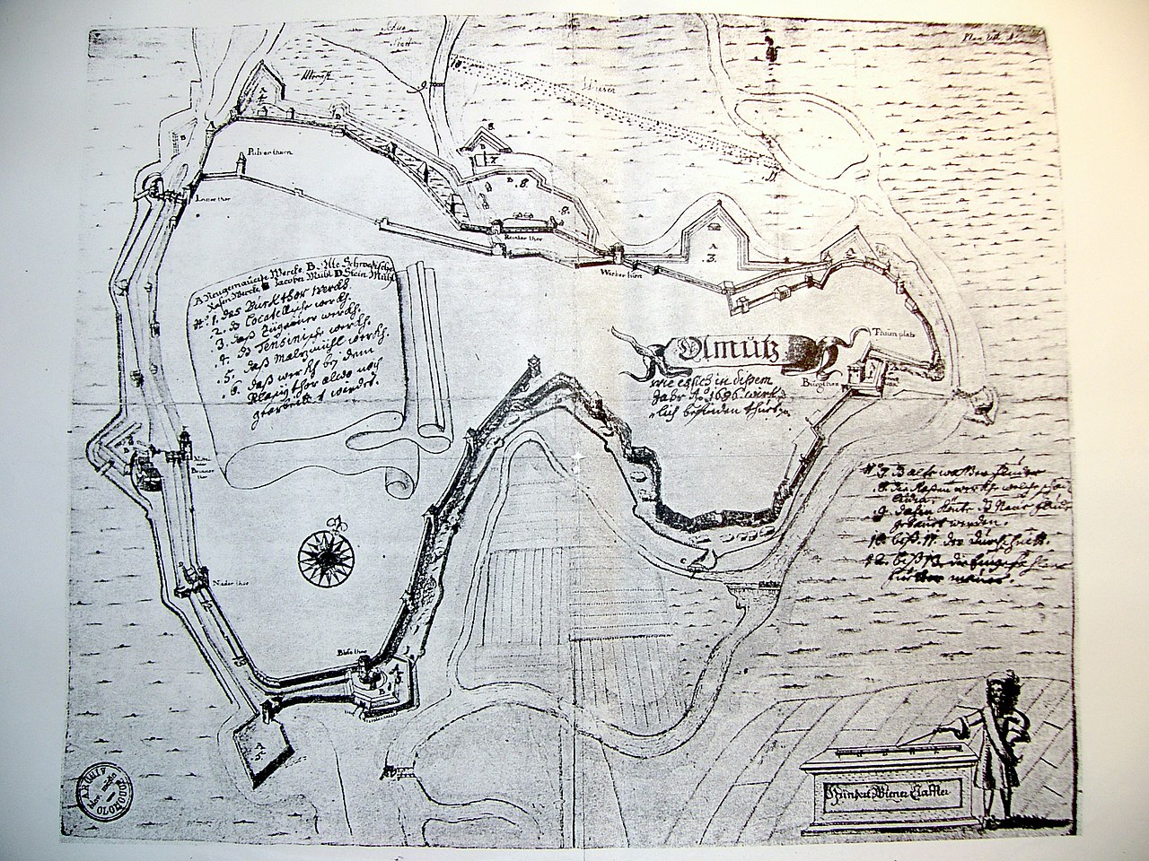
| Description | Čeština: Plán hradeb města Olomouce z roku 1686. (Fotografie černobílé kopie tohoto plánu.) | |||||||||||||
| Date | ||||||||||||||
| Source | Self-photographed | |||||||||||||
| Author | Photograph:
| |||||||||||||
| Permission (Reusing this file) |
| |||||||||||||
File history
Click on a date/time to view the file as it appeared at that time.
| Date/Time | Thumbnail | Dimensions | User | Comment | |
|---|---|---|---|---|---|
| current | 14:51, 20 April 2022 | | 2,304 × 1,728 (1.84 MB) | 0m9Ep | Brightness, color |
| 16:49, 11 February 2006 |  | 2,304 × 1,728 (1.62 MB) | Snek01 | *{{English}} Historcal map of Olomouc (Czech Republic) in 1686. Photo by Michal Maňas. *{{Czech}} Plán hradeb města Olomouce z roku 1686. (Fotografie černobílé kopie tohoto |
File usage
There are no pages that use this file.
Global file usage
The following other wikis use this file:
- Usage on cs.wikipedia.org
- Usage on de.wikipedia.org
- Usage on en.wikipedia.org
- Usage on it.wikipedia.org
- Usage on nl.wikipedia.org
- Usage on sl.wikipedia.org
- Usage on sv.wikipedia.org
Metadata
Explore the world

United states
New York

Japan
Tokyo

Singapore
Singapore
