
 Français
 Italiano
Size of this PNG preview of this SVG file: 473 × 599 pixels. Other resolutions: 189 × 240 pixels | 379 × 480 pixels | 606 × 768 pixels | 808 × 1,024 pixels | 1,616 × 2,048 pixels | 1,030 × 1,305 pixels.
Original file (SVG file, nominally 1,030 × 1,305 pixels, file size: 1.95 MB)
This is a file from the Wikimedia Commons and may be used by other projects. Information from its description page there is shown below. Commons is a freely licensed media file repository. |
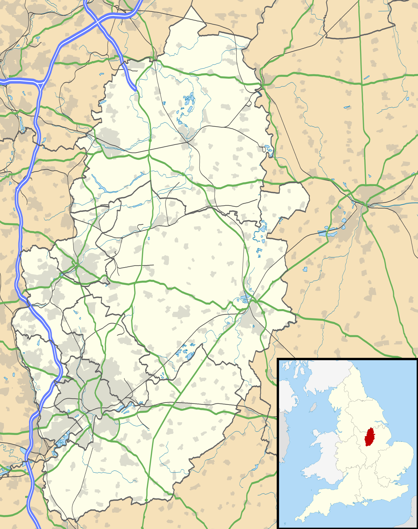
| Description | Map of Nottinghamshire, UK with the following information shown:
Equirectangular map projection on WGS 84 datum, with N/S stretched 165% Geographic limits:
|
| Date | |
| Source |
|
| Author | Nilfanion, created using Ordnance Survey data |
| Permission (Reusing this file) | This file is licensed under the Creative Commons Attribution-Share Alike 3.0 Unported license. Attribution: Contains Ordnance Survey data © Crown copyright and database right
|
| Other versions | File:Nottinghamshire UK district map (blank).svg - Blank map |
.svg)
File history
Click on a date/time to view the file as it appeared at that time.
| Date/Time | Thumbnail | Dimensions | User | Comment | |
|---|---|---|---|---|---|
| current | 19:09, 26 September 2010 | | 1,030 × 1,305 (1.95 MB) | Nilfanion | {{Information |Description=Map of Nottinghamshire, UK with the following information shown: *Administrative borders *Coastline, lakes and rivers *Roads and railways *Urban areas Equirectangular map projection on WGS 84 datum, with N |
File usage
There are no pages that use this file.
Global file usage
The following other wikis use this file:
- Usage on ar.wikipedia.org
- Usage on bg.wikipedia.org
- Usage on br.wikipedia.org
- Usage on ceb.wikipedia.org
- Usage on en.wikipedia.org
- Newstead Abbey
- Beeston, Nottinghamshire
- Blyth, Nottinghamshire
- Worksop
- Newark-on-Trent
- Edwinstowe
- Nottingham Castle
- Gotham, Nottinghamshire
- Eastwood, Nottinghamshire
- Retford
- Ollerton
- Kimberley, Nottinghamshire
- The Park Estate
- Sutton Bonington
- Queen's Medical Centre
- Calverton, Nottinghamshire
- Wollaton Hall
- Newark Castle, Nottinghamshire
- Hucknall
- Arnold, Nottinghamshire
- Bircotes
- Manton, Nottinghamshire
- Scrooby
- Carlton, Nottinghamshire
- Bingham, Nottinghamshire
- West Bridgford
- Sutton-in-Ashfield
- Gamston, Rushcliffe
- Cotgrave
- RAF Syerston
- Blidworth
- Lenton, Nottingham
- Kirkby-in-Ashfield
- Tollerton, Nottinghamshire
- Rampton Secure Hospital
- Holme Pierrepont
- Zouch
- Nottingham station
- Mansfield Woodhouse
- Toton
- Redhill, Nottinghamshire
- Aslockton
- Clumber Park
- Spion Kop, Nottinghamshire
- Chilwell
View more global usage of this file.
Metadata
Explore the world

United states
New York

Japan
Tokyo

Singapore
Singapore
