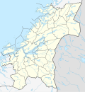
Size of this PNG preview of this SVG file: 554 × 600 pixels. Other resolutions: 222 × 240 pixels | 443 × 480 pixels | 709 × 768 pixels | 946 × 1,024 pixels | 1,892 × 2,048 pixels | 836 × 905 pixels.
Original file (SVG file, nominally 836 × 905 pixels, file size: 237 KB)
File history
Click on a date/time to view the file as it appeared at that time.
| Date/Time | Thumbnail | Dimensions | User | Comment | |
|---|---|---|---|---|---|
| current | 02:01, 8 June 2020 |  | 836 × 905 (237 KB) | Jay1279 | update after Nærøysund/Namsos and Indre Fosen/Steinkjer border adjustments in 2020 |
| 13:42, 2 January 2020 |  | 836 × 905 (229 KB) | NordNordWest | upd 2020 | |
| 18:19, 18 March 2019 |  | 836 × 905 (232 KB) | NordNordWest | upd 2019 | |
| 16:48, 7 January 2018 |  | 836 × 905 (232 KB) | NordNordWest | == {{int:filedesc}} == {{Information |description= {{de|1=Positionskarte von {{Wd|Trøndelag}}, {{Wd|Norwegen}}}} {{en|1=Location map of {{W|Trøndelag}}, {{W|Norway}}}} {{Location map series N (conic)|top=65.25|longitude=11.25|latitude1=64.25|latitude... |
File usage
There are no pages that use this file.
Global file usage
The following other wikis use this file:
- Usage on azb.wikipedia.org
- Usage on da.wikipedia.org
- Usage on de.wikipedia.org
- Kjeungskjær fyr
- Lerkendal-Stadion
- Trøndelag
- Grinna fyr
- Nordøyan fyr
- Buholmråsa fyr
- Wikipedia:Kartenwerkstatt/Positionskarten/Europa
- Skansenbrua
- Leangen Ishall
- Kråkmo (Trøndelag)
- Flughafen Røros
- Vorlage:Positionskarte Norwegen Trøndelag
- Bautasteine von Børsa
- Trondheim Spektrum
- Steinkjerbrücke
- Agdenes fyr
- Benutzer:Evolyzer/Gamle Bybrua
- Kya fyr
- Kolstad Arena
- Usage on en.wikipedia.org
View more global usage of this file.


 Français
 Italiano


