
 Français
 Italiano
Size of this PNG preview of this SVG file: 562 × 600 pixels. Other resolutions: 225 × 240 pixels | 450 × 480 pixels | 719 × 768 pixels | 959 × 1,024 pixels | 1,918 × 2,048 pixels | 740 × 790 pixels.
Original file (SVG file, nominally 740 × 790 pixels, file size: 54 KB)
This is a file from the Wikimedia Commons and may be used by other projects. Information from its description page there is shown below. Commons is a freely licensed media file repository. |
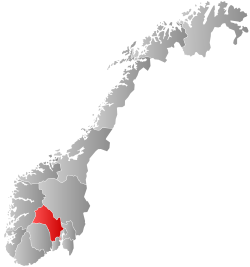
| Description | Autogenerated locator map of norwegian county as named in filename. |
| Date | |
| Source | Based on Image:Norway counties blank.svg |
| Author | Marmelad |
| Permission (Reusing this file) | Own work, share alike, attribution required (Creative Commons CC-BY-SA-2.5) |
I, the copyright holder of this work, hereby publish it under the following license:
This file is licensed under the Creative Commons Attribution-Share Alike 2.5 Generic license.
- You are free:
- to share – to copy, distribute and transmit the work
- to remix – to adapt the work
- Under the following conditions:
- attribution – You must give appropriate credit, provide a link to the license, and indicate if changes were made. You may do so in any reasonable manner, but not in any way that suggests the licensor endorses you or your use.
- share alike – If you remix, transform, or build upon the material, you must distribute your contributions under the same or compatible license as the original.
File history
Click on a date/time to view the file as it appeared at that time.
| Date/Time | Thumbnail | Dimensions | User | Comment | |
|---|---|---|---|---|---|
| current | 00:57, 2 January 2024 | | 740 × 790 (54 KB) | Jay1279 | update county borders for 2024 |
| 08:26, 27 January 2019 |  | 740 × 790 (67 KB) | Bjarkan | Border update (Rindal). | |
| 03:13, 17 December 2017 |  | 740 × 790 (67 KB) | Bjarkan | Improved version. | |
| 11:45, 24 January 2016 |  | 740 × 790 (81 KB) | Fleinn | Reverted to version as of 12:50, 16 August 2010 (UTC) | |
| 01:50, 19 January 2016 |  | 512 × 512 (82 KB) | Kingsocarso | Reverted to version as of 21:28, 21 September 2007 (UTC) | |
| 12:50, 16 August 2010 |  | 740 × 790 (81 KB) | Fleinn | Added gradient. | |
| 21:28, 21 September 2007 |  | 512 × 512 (82 KB) | Marmelad | {{Information |Description=Autogenerated locator map of norwegian county as named in filename. |Source=Based on Image:Norway counties blank.svg |Date=2007-09-21 |Author=Marmelad |Permission=Own work, share alike, attribution require |
File usage
There are no pages that use this file.
Global file usage
The following other wikis use this file:
- Usage on af.wikipedia.org
- Usage on ar.wikipedia.org
- Usage on ast.wikipedia.org
- Usage on azb.wikipedia.org
- Usage on bpy.wikipedia.org
- Usage on br.wikipedia.org
- Usage on bs.wikipedia.org
- Usage on da.wikipedia.org
- Usage on en.wikipedia.org
- Usage on eo.wikipedia.org
- Usage on eu.wikipedia.org
- Usage on fa.wikipedia.org
- Usage on fr.wikipedia.org
View more global usage of this file.
Metadata
Explore the world

United states
New York

Japan
Tokyo

Singapore
Singapore
