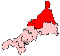
Size of this PNG preview of this SVG file: 207 × 193 pixels. Other resolutions: 257 × 240 pixels | 515 × 480 pixels | 824 × 768 pixels | 1,098 × 1,024 pixels | 2,197 × 2,048 pixels.
Original file (SVG file, nominally 207 × 193 pixels, file size: 155 KB)
File history
Click on a date/time to view the file as it appeared at that time.
| Date/Time | Thumbnail | Dimensions | User | Comment | |
|---|---|---|---|---|---|
| current | 00:14, 17 June 2008 |  | 207 × 193 (155 KB) | Wereon | == Summary == Map of the new UK Parliament constituency of North Cornwall. == Licensing == {{PD-self}} Category:Locator maps of parliamentary constituencies of Cornwall {{ImageUpload|basic}} |
File usage
There are no pages that use this file.
Global file usage
The following other wikis use this file:
- Usage on en.wikipedia.org
- Bodmin
- Padstow
- Tintagel
- Camelford
- Wadebridge
- Davidstow
- North Petherwin
- Advent, Cornwall
- Altarnun
- Warbstow
- Egloshayle
- St Mabyn
- St Tudy
- St Issey
- St Teath
- St Minver
- St Eval
- Bude–Stratton
- Blisland
- Boyton, Cornwall
- Jacobstow
- Morwenstow
- Marhamchurch
- St Clether
- Lewannick
- St Ervan
- Whitstone
- Lesnewth
- St Juliot
- St Kew
- Laneast
- St Merryn
- Stoke Climsland
- Wikipedia:WikiProject Cornwall
- Wikipedia:WikiProject Cornwall/Templates
- Kilkhampton
- Cardinham
- Egloskerry
- Lanivet
- Helland
- Werrington, Cornwall
- St Breward
- St Endellion
- Michaelstow
- Withiel
- Launcells
- Wikipedia talk:WikiProject Cornwall/Archive 3
- Week St Mary
- North Hill, Cornwall
- St Gennys
View more global usage of this file.


 Français
 Italiano


