Size of this preview: 600 × 600 pixels. Other resolutions: 240 × 240 pixels | 480 × 480 pixels | 768 × 768 pixels | 1,080 × 1,080 pixels.
Original file (1,080 × 1,080 pixels, file size: 3.34 MB, MIME type: image/png)
File history
Click on a date/time to view the file as it appeared at that time.
| Date/Time | Thumbnail | Dimensions | User | Comment | |
|---|---|---|---|---|---|
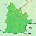
| current | 18:07, 19 September 2010 |  | 1,080 × 1,080 (3.34 MB) | Adehertogh | {{Information |Description=Background map of the Nitra Region, Slovakia, ready for the Geobox template, calibrated at en:Template:Geobox locator Nitra Region Outline map of the Nitra Region, Slovakia, ready for the [[:en:Templ |
File usage
There are no pages that use this file.
Global file usage
The following other wikis use this file:
- Usage on bg.wikipedia.org
- Usage on en.wikipedia.org
- Nitra
- Komárno
- Nové Zámky
- Komjatice
- Slatina, Levice District
- Zlaté Moravce
- Šahy
- Levice
- Topoľčany
- Štúrovo
- Šaľa
- Kolárovo
- Svrbice
- Želiezovce
- Virt
- Dedina Mládeže
- Radvaň nad Dunajom
- Vráble
- Čierne Kľačany
- Skýcov
- Brhlovce
- Šurany
- Alekšince
- Jelenec
- Melek, Nitra District
- Andovce
- Diakovce
- Ardanovce
- Belince
- Biskupová
- Blesovce
- Bojná
- Čeľadince
- Čermany
- Dvorany nad Nitrou
- Hajná Nová Ves
- Horné Chlebany
- Horné Obdokovce
- Horné Štitáre
View more global usage of this file.


 Français
 Italiano


