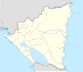
Size of this PNG preview of this SVG file: 704 × 599 pixels. Other resolutions: 282 × 240 pixels | 564 × 480 pixels | 902 × 768 pixels | 1,203 × 1,024 pixels | 2,405 × 2,048 pixels | 1,400 × 1,192 pixels.
Original file (SVG file, nominally 1,400 × 1,192 pixels, file size: 192 KB)
File history
Click on a date/time to view the file as it appeared at that time.
| Date/Time | Thumbnail | Dimensions | User | Comment | |
|---|---|---|---|---|---|
| current | 06:36, 25 May 2021 |  | 1,400 × 1,192 (192 KB) | Milenioscuro | corrected some errors |
| 06:30, 25 May 2021 |  | 1,400 × 1,192 (192 KB) | Milenioscuro | corrected department boundaries | |
| 22:09, 17 February 2010 |  | 1,400 × 1,192 (416 KB) | Alexrk2 | - | |
| 20:12, 16 February 2010 |  | 1,400 × 1,192 (415 KB) | Alexrk2 | == Summary == {{Information |Description= {{de|Positionskarte Nicaragua mit Departamentos, Quadratische Plattkarte, N-S-Streckung 100 %. Geographische Begrenzung der Karte:}} {{en|Location map Nicaragua with Departament |
File usage
There are no pages that use this file.
Global file usage
The following other wikis use this file:
- Usage on af.wikipedia.org
- Usage on an.wikipedia.org
- Usage on ar.wikipedia.org
- Usage on ast.wikipedia.org
- Greytown (Nicaragua)
- Zapatera (volcán)
- Managua
- Matiguás
- Muy Muy
- Llagu Apanás
- Módulu:Mapa de llocalización/datos/Nicaragua
- Módulu:Mapa de llocalización/datos/Nicaragua/usu
- Aeropuertu Bonanza
- Aeropuertu Punta Huete
- Aeropuertu de Chinandega
- Aeropuertu de Juigalpa
- Aeropuertu de Los Brasiles
- Aeropuertu de Montelimar
- Aeropuertu de Nueva Guinea
- Aeropuertu d'Ometepe
- Aeropuertu de Rosita
- Aeropuertu de San Juan de Nicaragua
- Aeropuertu de Siuna
- Aeropuertu de Waspán
- Aeropuertu internacional Costa Esmeralda
- San Isidro (Nicaragua)
- León (Nicaragua)
- Usage on ba.wikipedia.org
- Usage on be-tarask.wikipedia.org
- Usage on be.wikipedia.org
- Usage on bg.wikipedia.org
- Usage on bh.wikipedia.org
- Usage on bn.wikipedia.org
View more global usage of this file.


 Français
 Italiano


