
 Français
 Italiano
Size of this preview: 800 × 600 pixels. Other resolutions: 320 × 240 pixels | 640 × 480 pixels | 1,024 × 768 pixels | 1,280 × 960 pixels | 2,560 × 1,920 pixels | 3,566 × 2,674 pixels.
Original file (3,566 × 2,674 pixels, file size: 1.03 MB, MIME type: image/jpeg)
This is a file from the Wikimedia Commons and may be used by other projects. Information from its description page there is shown below. Commons is a freely licensed media file repository. |
Summary
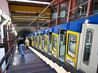
| Description | Stazione Vomero Via Morghen |
| Date | |
| Source | Napoli - Funicolare di Montesanto |
| Author | Armando Mancini from Napoli, Italia |
| Camera location | | View this and other nearby images on: OpenStreetMap |
|---|
Licensing
This file is licensed under the Creative Commons Attribution-Share Alike 2.0 Generic license.
- You are free:
- to share – to copy, distribute and transmit the work
- to remix – to adapt the work
- Under the following conditions:
- attribution – You must give appropriate credit, provide a link to the license, and indicate if changes were made. You may do so in any reasonable manner, but not in any way that suggests the licensor endorses you or your use.
- share alike – If you remix, transform, or build upon the material, you must distribute your contributions under the same or compatible license as the original.
| This image, originally posted to Flickr, was reviewed on 23 June 2011 by the administrator or reviewer Leoboudv, who confirmed that it was available on Flickr under the stated license on that date. |
File history
Click on a date/time to view the file as it appeared at that time.
| Date/Time | Thumbnail | Dimensions | User | Comment | |
|---|---|---|---|---|---|
| current | 20:27, 23 June 2011 | | 3,566 × 2,674 (1.03 MB) | Nevertime | {{Information |Description=Stazione Vomero Via Morghen |Source=[http://www.flickr.com/photos/armando46/4340528753/ Napoli - Funicolare di Montesanto] |Date=2010-02-08 16:07 |Author=[http://www.flickr.com/people/13428228@N07 Armando Mancini] from Napoli, I |
File usage
The following page uses this file:
Global file usage
The following other wikis use this file:
- Usage on ar.wikipedia.org
- Usage on de.wikipedia.org
- Usage on en.wikipedia.org
- Usage on fr.wikipedia.org
- Usage on it.wikipedia.org
- Usage on pl.wikivoyage.org
- Usage on vi.wikipedia.org
- Usage on www.wikidata.org
Metadata
Explore the world

United states
New York

Japan
Tokyo

Singapore
Singapore
