
 Français
 Italiano
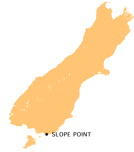
No higher resolution available.
NZ-Slope_P.png (440 × 497 pixels, file size: 32 KB, MIME type: image/png)
This is a file from the Wikimedia Commons and may be used by other projects. Information from its description page there is shown below. Commons is a freely licensed media file repository. |
Summary
| Description | Mapa de la Isla Sur mostrando Slope Point, Nueva Zelanda English: Location map of Slope Point, New Zealand |
| Date | |
| Source | wiki :en |
| Author | uploaded by en:User:Grutness |
| Permission (Reusing this file) | Dominio Público |
Licensing
| This work has been released into the public domain by its author, Grutness. This applies worldwide. In some countries this may not be legally possible; if so: |
File history
Click on a date/time to view the file as it appeared at that time.
| Date/Time | Thumbnail | Dimensions | User | Comment | |
|---|---|---|---|---|---|
| current | 12:20, 20 March 2007 | | 440 × 497 (32 KB) | Guanxito~commonswiki | {{Information |Description=Mapa de la Isla Sur mostrando Slope Point, Nueva Zelanda |Source=wiki :en |Date=20/03/2007 |Author= |Permission=Dominio Público |other_versions= }} |
File usage
There are no pages that use this file.
Global file usage
The following other wikis use this file:
- Usage on en.wikipedia.org
- Usage on pt.wikipedia.org
- Usage on th.wikipedia.org
Explore the world

United states
New York

Japan
Tokyo

Singapore
Singapore
