
 Français
 Italiano
Size of this preview: 398 × 599 pixels. Other resolutions: 159 × 240 pixels | 319 × 480 pixels | 510 × 768 pixels | 680 × 1,024 pixels | 1,329 × 2,000 pixels.
Original file (1,329 × 2,000 pixels, file size: 1.23 MB, MIME type: image/jpeg)
This is a file from the Wikimedia Commons and may be used by other projects. Information from its description page there is shown below. Commons is a freely licensed media file repository. |
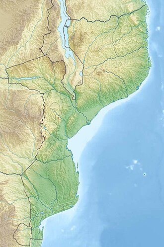
| Description | Deutsch: Physische Positionskarte von Mosambik Quadratische Plattkarte, N-S-Streckung 105 %. Geographische Begrenzung der Karte:
English: Physical location map of Mozambique Equirectangular projection, N/S stretching 105 %. Geographic limits of the map:
|
| Date | |
| Source | Own work, using
|
| Author | Carport |
| Permission (Reusing this file) | This file is licensed under the Creative Commons Attribution-Share Alike 3.0 Unported license.
|
| Other versions |
|

File history
Click on a date/time to view the file as it appeared at that time.
| Date/Time | Thumbnail | Dimensions | User | Comment | |
|---|---|---|---|---|---|
| current | 20:31, 3 March 2020 | | 1,329 × 2,000 (1.23 MB) | Sémhur | Adding Tanzanian border claim (from https://www.nbs.go.tz/index.php/en/census-surveys/gis/385-2012-phc-shapefiles-level-one-and-two) |
| 21:30, 15 December 2012 |  | 1,329 × 2,000 (1.11 MB) | Carport | {{Information |Description= {{de|Physische Positionskarte von Mosambik}} Quadratische Plattkarte, N-S-Streckung 105 %. Geographische Begrenzung der Karte: * N: 10.2° S * S: 27.4° S * W: 29.8° O * O: 41.8° O {{en|Location map of [[:... |
File usage
There are no pages that use this file.
Global file usage
The following other wikis use this file:
- Usage on af.wikipedia.org
- Usage on ar.wikipedia.org
- Usage on ast.wikipedia.org
- Usage on az.wikipedia.org
- Usage on ban.wikipedia.org
- Usage on bg.wikipedia.org
- Usage on bn.wikipedia.org
- Usage on bs.wikipedia.org
- Usage on ca.wikipedia.org
- Usage on ceb.wikipedia.org
- Usage on ce.wikipedia.org
- Usage on da.wikipedia.org
- Usage on de.wikipedia.org
- Mosambik
- Cahora-Bassa-Talsperre
- Ilha de Moçambique
- Monte Binga
- Bazaruto
- Maputo-Bucht
- Vorlage:Positionskarte Mosambik
- Monte Namuli
- Nationalpark Gorongosa
- Wikipedia:Kartenwerkstatt/Positionskarten/Afrika
- Quirimbas
- Inhaca
- Ibo (Insel)
- Monte Mabu
- Amaramba-See
- Angoche (Insel)
- Grande Hotel Beira
- Massingir-Talsperre
- Liste von Kraftwerken in Mosambik
- Benguerra
- Bucht von Tungue
- Usage on de.wikivoyage.org
View more global usage of this file.
Explore the world

United states
New York

Japan
Tokyo

Singapore
Singapore
