
 Français
 Italiano
Size of this PNG preview of this SVG file: 800 × 566 pixels. Other resolutions: 320 × 227 pixels | 640 × 453 pixels | 1,024 × 725 pixels | 1,280 × 906 pixels | 2,560 × 1,812 pixels | 3,532 × 2,500 pixels.
Original file (SVG file, nominally 3,532 × 2,500 pixels, file size: 1.31 MB)
This is a file from the Wikimedia Commons and may be used by other projects. Information from its description page there is shown below. Commons is a freely licensed media file repository. |
W3C-validity not checked.
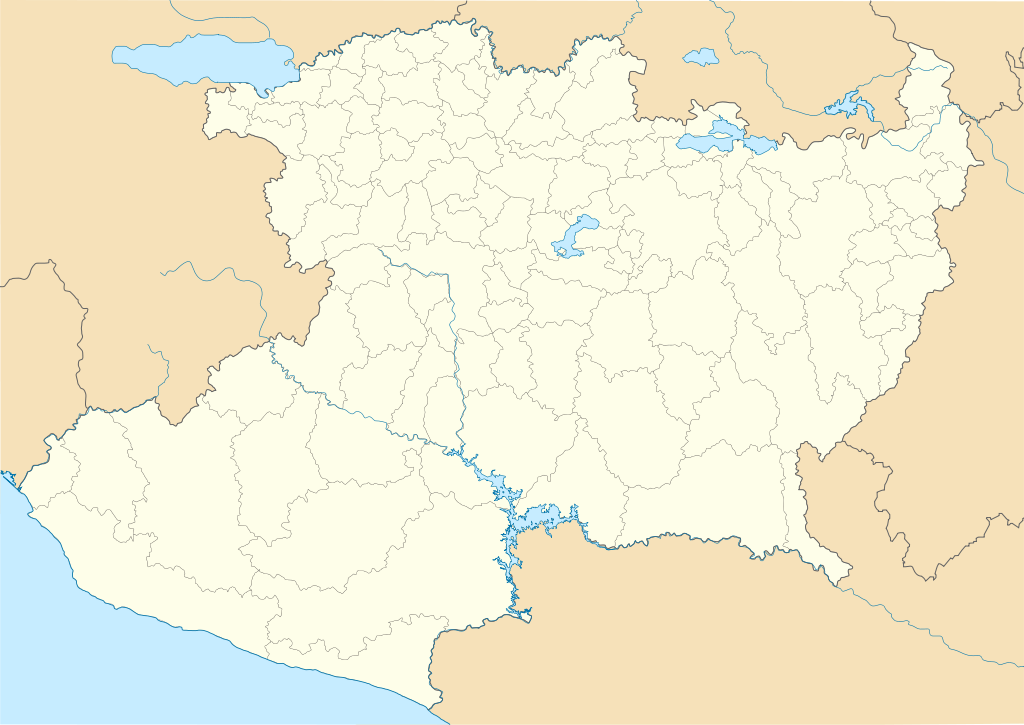
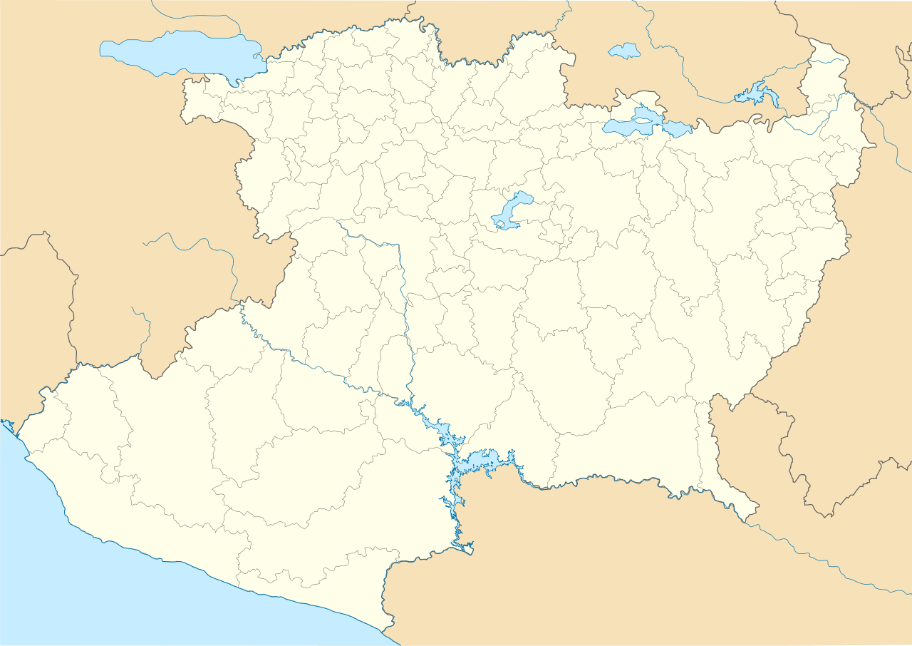
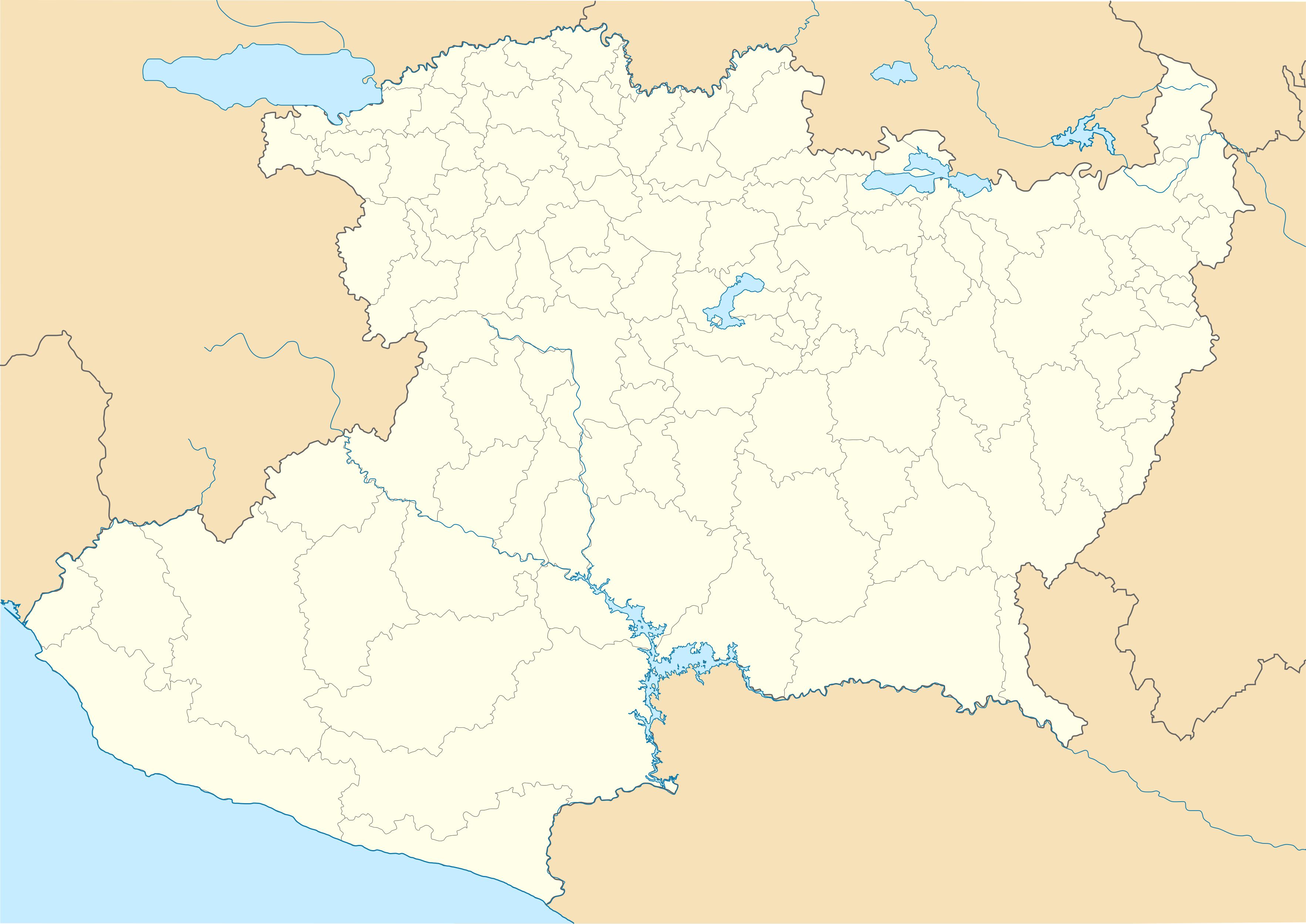
| Description | Location Map of Michoacán Equirectangular projection, Geographic limits of the map:
|
| Date | |
| Source | Own work |
| Author | Battroid (talk) |
I, the copyright holder of this work, hereby publish it under the following license:
| I, the copyright holder of this work, release this work into the public domain. This applies worldwide. In some countries this may not be legally possible; if so: I grant anyone the right to use this work for any purpose, without any conditions, unless such conditions are required by law. |
File history
Click on a date/time to view the file as it appeared at that time.
| Date/Time | Thumbnail | Dimensions | User | Comment | |
|---|---|---|---|---|---|
| current | 00:23, 14 November 2011 | | 3,532 × 2,500 (1.31 MB) | Battroid | {{ValidSVG}} {{Information |Description=Location Map of Michoacán Equirectangular projection, Geographic limits of the map: * N: 20.49° N * S: 17.85° N * W: 103.83° W * E: 99.88° W |Source={{own work}} |Date=2011-11-13 |Author=[[Us |
File usage
There are no pages that use this file.
Global file usage
The following other wikis use this file:
- Usage on ar.wikipedia.org
- Usage on ast.wikipedia.org
- Usage on ba.wikipedia.org
- Usage on bg.wikipedia.org
- Usage on bn.wikipedia.org
- Usage on ceb.wikipedia.org
- Usage on ce.wikipedia.org
- Usage on de.wikipedia.org
- Puruándiro
- Zamora de Hidalgo
- Paricutín
- Morelia
- Los Reyes de Salgado
- Pátzcuaro
- Tzintzuntzan
- Tuxpan (Michoacán)
- Uruapan
- Pátzcuaro-See
- La Piedad de Cabadas
- Wikipedia:Kartenwerkstatt/Positionskarten/Nordamerika
- Estadio Morelos
- Ciudad Lázaro Cárdenas
- Nuevo San Juan Parangaricutiro
- Apatzingán de la Constitución
- Vorlage:Positionskarte Mexiko Michoacán
- Estadio Juan Nepomuceno López
- Estadio Venustiano Carranza
- Playa Azul (Michoacán)
- Tlalpujahua
- Nationalpark Barranca del Cupatitzio
- Nueva Italia de Ruiz
- Santa Clara del Cobre
- Maravatío
- Tancítaro
- Angangueo
- Tacámbaro de Codallos
- Jiquilpan de Juárez
- Nationalpark Pico de Tancítaro
- Paracho de Verduzco
- Usage on en.wikipedia.org
View more global usage of this file.
Metadata
Explore the world

United states
New York

Japan
Tokyo

Singapore
Singapore
