
 Français
 Italiano
Size of this PNG preview of this SVG file: 440 × 600 pixels. Other resolutions: 176 × 240 pixels | 352 × 480 pixels | 563 × 768 pixels | 751 × 1,024 pixels | 1,503 × 2,048 pixels | 1,400 × 1,908 pixels.
Original file (SVG file, nominally 1,400 × 1,908 pixels, file size: 136 KB)
This is a file from the Wikimedia Commons and may be used by other projects. Information from its description page there is shown below. Commons is a freely licensed media file repository. |
Summary
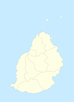
| Description | English: Location map of Mauritius Equirectangular projection. Stretched by 106.0%. Geographic limits of the map:
|
| Date | |
| Source | Own work |
| Author | Uwe Dedering |
Licensing
Uwe Dedering at German Wikipedia, the copyright holder of this work, hereby publishes it under the following licenses:
 | Permission is granted to copy, distribute and/or modify this document under the terms of the GNU Free Documentation License, Version 1.2 or any later version published by the Free Software Foundation; with no Invariant Sections, no Front-Cover Texts, and no Back-Cover Texts. A copy of the license is included in the section entitled GNU Free Documentation License. |
This file is licensed under the Creative Commons Attribution-Share Alike 3.0 Unported license.
Attribution: Uwe Dedering at German Wikipedia
- You are free:
- to share – to copy, distribute and transmit the work
- to remix – to adapt the work
- Under the following conditions:
- attribution – You must give appropriate credit, provide a link to the license, and indicate if changes were made. You may do so in any reasonable manner, but not in any way that suggests the licensor endorses you or your use.
- share alike – If you remix, transform, or build upon the material, you must distribute your contributions under the same or compatible license as the original.
This file is licensed under the Creative Commons Attribution-Share Alike 3.0 Germany license.
Attribution: Uwe Dedering at German Wikipedia
- You are free:
- to share – to copy, distribute and transmit the work
- to remix – to adapt the work
- Under the following conditions:
- attribution – You must give appropriate credit, provide a link to the license, and indicate if changes were made. You may do so in any reasonable manner, but not in any way that suggests the licensor endorses you or your use.
- share alike – If you remix, transform, or build upon the material, you must distribute your contributions under the same or compatible license as the original.

You may select the license of your choice.
Original upload log
Transferred from de.wikipedia to Commons by Uwe Dedering.
The original description page was here. All following user names refer to de.wikipedia.
- 2010-02-16 15:29 Uwe Dedering 1400×1908× (52333 bytes) {{Information |Beschreibung = Location map of Mauritius Equirectangular projection. Stretched by 106.0%. Geographic limits of the map: * N: -19.7° N * S: -20.6° N * W: 57.21° E * E: 57.91° E Made with Natural Earth. Free vector and raster map data @ naturalearthdata.com. |Quelle = own work |Urheber = [[Benutzer:Uwe Dedering|Uwe Dedering]] |Datum = 20100216 |Genehmigung = |Andere Versionen = |Anmerkungen = more islands }}
- 2010-02-16 12:41 Uwe Dedering 1400×1484× (16125 bytes) {{Information |Beschreibung = Location map of Mauritius Equirectangular projection. Stretched by 106.0%. Geographic limits of the map: * N: -19.9° N * S: -20.6° N * W: 57.2° E * E: 57.9° E Made with Natural Earth. Free vector and raster map da
File history
Click on a date/time to view the file as it appeared at that time.
| Date/Time | Thumbnail | Dimensions | User | Comment | |
|---|---|---|---|---|---|
| current | 18:14, 5 October 2011 | | 1,400 × 1,908 (136 KB) | Yash400 | Reverted to version as of 14:15, 9 December 2010 |
| 18:12, 5 October 2011 |  | 1,400 × 1,908 (136 KB) | Yash400 | Reverted to version as of 14:15, 9 December 2010 | |
| 18:11, 5 October 2011 |  | 1,400 × 1,908 (136 KB) | Yash400 | Reverted to version as of 14:15, 9 December 2010 | |
| 18:11, 5 October 2011 |  | 1,400 × 1,908 (41 KB) | Yash400 | Reverted to version as of 10:10, 2 October 2011 | |
| 18:16, 2 October 2011 |  | 1,400 × 1,908 (39 KB) | Yash400 | change colour | |
| 10:10, 2 October 2011 |  | 1,400 × 1,908 (41 KB) | Yash400 | exact size needed | |
| 09:54, 2 October 2011 |  | 1,810 × 2,160 (1.3 MB) | Yash400 | update size of map | |
| 09:42, 2 October 2011 |  | 1,810 × 2,160 (1.3 MB) | Yash400 | more islets added | |
| 14:15, 9 December 2010 |  | 1,400 × 1,908 (136 KB) | Uwe Dedering | coastline completly new | |
| 21:56, 16 February 2010 |  | 1,400 × 1,908 (51 KB) | Uwe Dedering | {{Information |Description={{de|Location map of Mauritius Equirectangular projection. Stretched by 106.0%. Geographic limits of the map: * N: -19.7° N * S: -20.6° N * W: 57.21° E * E: 57.91° E Made with Natural Earth. Free vector and raster map data @ |
File usage
There are no pages that use this file.
Global file usage
The following other wikis use this file:
- Usage on af.wikipedia.org
- Usage on am.wikipedia.org
- Usage on an.wikipedia.org
- Usage on ar.wikipedia.org
- Usage on ast.wikipedia.org
- Usage on az.wikipedia.org
- Usage on ba.wikipedia.org
- Usage on be-tarask.wikipedia.org
- Usage on be.wikipedia.org
- Usage on bg.wikipedia.org
- Usage on bn.wikipedia.org
- Usage on bs.wikipedia.org
- Usage on ca.wikipedia.org
- Usage on ceb.wikipedia.org
- Plantilya:Location map Mauritius
- Sandy Island
- Sandy Islet
- The Narrows
- Bird Island
- Bird Islet
- Rocky Point
- Cat Island
- Devils Point
- Sand Point
- The Bluff
- Diamond Point
- Combo
- Nelson
- Noire
- West Peak
- Whale Rock
- Albion
- Oliva (pagklaro)
- Rodriguez
- East Peak
- Flat Island
- Saint-André (pagklaro)
- Roche Baleine
- Grande Pointe
- Ile Coco
View more global usage of this file.
Explore the world

United states
New York

Japan
Tokyo

Singapore
Singapore
