
 Français
 Italiano
Size of this PNG preview of this SVG file: 634 × 600 pixels. Other resolutions: 254 × 240 pixels | 507 × 480 pixels | 812 × 768 pixels | 1,082 × 1,024 pixels | 2,165 × 2,048 pixels | 780 × 738 pixels.
Original file (SVG file, nominally 780 × 738 pixels, file size: 101 KB)
This is a file from the Wikimedia Commons and may be used by other projects. Information from its description page there is shown below. Commons is a freely licensed media file repository. |
Summary
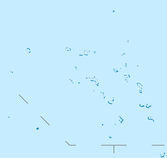
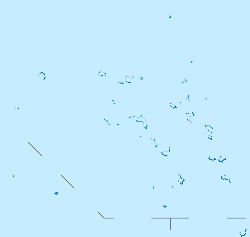
| Description | Deutsch: Positionskarte der Marshallinseln Quadratische Plattkarte. Geographische Begrenzung der Karte:
English: Location map of the Marshall Islands Equirectangular projection. Geographic limits of the map:
|
| Date | |
| Source | own work, using
|
| Author | NordNordWest |
 | This map has been made or improved in the German Kartenwerkstatt (Map Lab). You can propose maps to improve as well. |
Licensing
I, the copyright holder of this work, hereby publish it under the following licenses:
 | Permission is granted to copy, distribute and/or modify this document under the terms of the GNU Free Documentation License, Version 1.2 or any later version published by the Free Software Foundation; with no Invariant Sections, no Front-Cover Texts, and no Back-Cover Texts. A copy of the license is included in the section entitled GNU Free Documentation License. |
This file is licensed under the Creative Commons Attribution 3.0 Unported license.
- You are free:
- to share – to copy, distribute and transmit the work
- to remix – to adapt the work
- Under the following conditions:
- attribution – You must give appropriate credit, provide a link to the license, and indicate if changes were made. You may do so in any reasonable manner, but not in any way that suggests the licensor endorses you or your use.
You may select the license of your choice.
File history
Click on a date/time to view the file as it appeared at that time.
| Date/Time | Thumbnail | Dimensions | User | Comment | |
|---|---|---|---|---|---|
| current | 19:02, 16 November 2011 | | 780 × 738 (101 KB) | NordNordWest | upd |
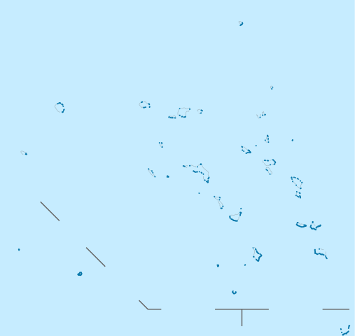
| 10:33, 17 April 2009 |  | 780 × 738 (105 KB) | NordNordWest | {{Information |Description= {{de|Positionskarte der Marshallinseln}} Quadratische Plattkarte. Geographische Begrenzung der Karte: * N: 15.5° N * S: 3.0° N * W: 160.0° O * O: 173.2° O {{en|Location map of the [[:en:Marshall Islan |
File usage
There are no pages that use this file.
Global file usage
The following other wikis use this file:
- Usage on af.wikipedia.org
- Usage on an.wikipedia.org
- Usage on ar.wikipedia.org
- Usage on ast.wikipedia.org
- Mayuru
- Roi-Namur
- Módulu:Mapa de llocalización/datos/Islles Márxal
- Kwajalein
- Cadena Ralik
- Atolón d'Ailinginae
- Islla Jabat
- Atolón Ebon
- Islla de Lib
- Enewetak
- Atolón de Lae
- Jaluit
- Atolón de Namdrik
- Atolón de Namu
- Atolón de Rongerik
- Rongelap
- Islla de Kili
- Atolón de Wotho
- Atolón d'Ujae
- Atolón d'Ujelang
- Atolón d'Arno
- Atolón d'Aur
- Atolón de Bokak
- Atolón d'Erikub
- Atolón de Nadikdik
- Pasaxe de Klee
- Atolón de Bikar
- Mejit
- Wotje
- Atolón de Toke
- Likiep
- Atolón d'Ailuk
- Maloelap
- Atolón d'Utirik
- Atolón d'Ailinglaplap
- Atolón de Mili
- Runit
- Delap-Uliga-Djarrit
- Aeropuertu Internacional Amata Kabua
- Aeropuertu del Atolón Bikini
- Módulu:Mapa de llocalización/datos/Islles Márxal/usu
- Usage on az.wikipedia.org
- Usage on ba.wikipedia.org
- Usage on be.wikipedia.org
View more global usage of this file.
Explore the world

United states
New York

Japan
Tokyo

Singapore
Singapore
