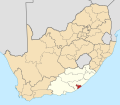
Size of this PNG preview of this SVG file: 684 × 599 pixels. Other resolutions: 274 × 240 pixels | 548 × 480 pixels | 876 × 768 pixels | 1,168 × 1,024 pixels | 2,337 × 2,048 pixels | 809 × 709 pixels.
Original file (SVG file, nominally 809 × 709 pixels, file size: 487 KB)
File history
Click on a date/time to view the file as it appeared at that time.
| Date/Time | Thumbnail | Dimensions | User | Comment | |
|---|---|---|---|---|---|
| current | 13:55, 2 May 2011 |  | 809 × 709 (487 KB) | Htonl | == Summary == {{Information |Description ={{en|1=Map of district boundaries in South Africa, as they will be after the municipal elections of 18 May 2011, with the [[w:Buffalo City Metropolitan Municipality] |
File usage
There are no pages that use this file.
Global file usage
The following other wikis use this file:
- Usage on af.wikipedia.org
- Bhisho
- Oos-Londen
- Qonce
- Potsdam, Oos-Kaap
- Kidd's Beach
- Breidbach
- Zwelitsha
- Berlyn, Oos-Kaap
- Dimbaza
- Gonubie
- Duncan Village
- Mdantsane
- Sjabloonbespreking:Suid-Afrikaanse distriksmunisipaliteit navbox
- Cambridge, Oos-Londen
- Macleantown
- Mount Coke
- Sunrise-on-Sea
- Kayser's Beach
- Quigney
- Inglewood
- Gompo
- Need's Camp
- Ducats
- Modaka
- Mbekweni
- Kwetyana
- Eluxolweni
- Ententeni
- Ginsberg
- Goodhope, Buffalo City
- Ilitha
- Kuni
- KwaLini
- KwaTshatshu
- Ndevana
- UMzantsi, Oos-Kaap
- Tyutyu
- Tolofiyeni
- Phakamisa, Oos-Kaap
- Nompumelelo
- Mzamomhle, Buffalo City
- Usage on en.wikipedia.org
View more global usage of this file.


 Français
 Italiano


