
 Français
 Italiano
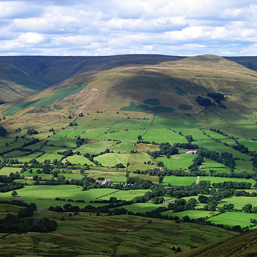
Size of this preview: 600 × 600 pixels. Other resolutions: 240 × 240 pixels | 480 × 480 pixels | 1,000 × 1,000 pixels.
Original file (1,000 × 1,000 pixels, file size: 180 KB, MIME type: image/jpeg)
This is a file from the Wikimedia Commons and may be used by other projects. Information from its description page there is shown below. Commons is a freely licensed media file repository. |
| Description | View down the valley from Mam Tor in the en:Peak District, UK. Twelve large en:limestone quarries operate in the Peak District Photographed by Bala Amavasai Camera: Canon A520 |
| Date | 10 August 2005 (original upload date) |
| Source | Originally from en.wikipedia; description page is/was here. |
| Author | The original uploader was Bpa at English Wikipedia. |
| This file is licensed under the Creative Commons Attribution-Share Alike 3.0 Unported license. Subject to disclaimers. | ||
| ||
| This licensing tag was added to this file as part of the GFDL licensing update. |
 | Permission is granted to copy, distribute and/or modify this document under the terms of the GNU Free Documentation License, Version 1.2 or any later version published by the Free Software Foundation; with no Invariant Sections, no Front-Cover Texts, and no Back-Cover Texts. A copy of the license is included in the section entitled GNU Free Documentation License. Subject to disclaimers. |
(All user names refer to en.wikipedia)
- 2005-08-10 17:02 Bpa 1000×1000×8 (184106 bytes) View down the valley from Mam Tor
File history
Click on a date/time to view the file as it appeared at that time.
| Date/Time | Thumbnail | Dimensions | User | Comment | |
|---|---|---|---|---|---|
| current | 18:18, 14 July 2007 | | 1,000 × 1,000 (180 KB) | Finavon | {{Information |Description=View down the valley from Mam Tor in the Peak District, UK. Photographed by Bala Amavasai Camera: Canon A520 |Source=Originally from [http://en.wikipedia.org en.wikipedia]; description page is/was [http://en.wikipedia.org/w/ |
File usage
There are no pages that use this file.
Global file usage
The following other wikis use this file:
- Usage on br.wikipedia.org
- Usage on en.wikipedia.org
- Mam Tor
- Bocage
- The Roaches
- Hartington, Derbyshire
- Stanage Edge
- Kinder Scout
- Heights of Abraham
- Dovedale
- Bleaklow
- Black Hill (Peak District)
- Thorpe Cloud
- Lose Hill
- Shining Tor
- Win Hill
- User:Bpa
- Wolfscote Hill
- Axe Edge Moor
- Crook Hill
- Parkhouse Hill
- Alport Height
- Chrome Hill
- Derwent Edge
- Shutlingsloe
- Minninglow
- Margery Hill
- Stanton Moor
- Gun (Staffordshire)
- Eldon Hill
- The Cloud (hill)
- Higger Tor
- Rushup Edge
- Tegg's Nose
- Template:Peaks of the Peak District
- High Stones
- High Wheeldon
- Wetton, Staffordshire
- Grindslow Knoll
- Croker Hill
- Eccles Pike
- Brown Knoll
- Featherbed Moss
- Featherbed Top
- Mill Hill (Derbyshire)
- Britland Edge Hill
- Lost Lad
- Oliver Hill (Peak District)
- Black Edge
- Combs Moss
- Grin Low
View more global usage of this file.
Metadata
Explore the world

United states
New York

Japan
Tokyo

Singapore
Singapore
