
 Français
 Italiano
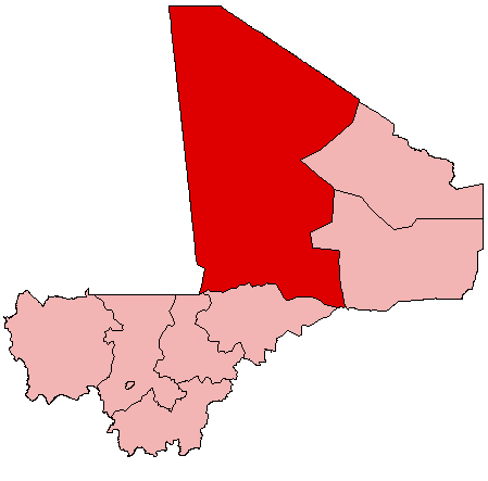
No higher resolution available.
Mali_Tombouctou.png (449 × 443 pixels, file size: 5 KB, MIME type: image/png)
This is a file from the Wikimedia Commons and may be used by other projects. Information from its description page there is shown below. Commons is a freely licensed media file repository. |
| Description | English: Map of Mali showing Tombouctou Region; created with the GIMP. Made by en:User:Acntx. |
| Date | 31 July 2005 (original upload date) |
| Source | Transferred from en.wikipedia to Commons. |
| Author | The original uploader was Acntx at English Wikipedia. |
Licensing
| This file is licensed under the Creative Commons Attribution-Share Alike 3.0 Unported license. Subject to disclaimers. | ||
| ||
| This licensing tag was added to this file as part of the GFDL licensing update. |
 | Permission is granted to copy, distribute and/or modify this document under the terms of the GNU Free Documentation License, Version 1.2 or any later version published by the Free Software Foundation; with no Invariant Sections, no Front-Cover Texts, and no Back-Cover Texts. A copy of the license is included in the section entitled GNU Free Documentation License. Subject to disclaimers. |
Original upload log
The original description page was here. All following user names refer to en.wikipedia.
- 2005-07-31 21:25 Acntx 449×443× (5317 bytes)
File history
Click on a date/time to view the file as it appeared at that time.
| Date/Time | Thumbnail | Dimensions | User | Comment | |
|---|---|---|---|---|---|
| current | 09:57, 13 November 2008 | | 449 × 443 (5 KB) | YoaR~commonswiki | {{Information |Description={{en|Map of Mali showing Tombouctou Region; created with the GIMP. Made by en:User:Acntx.}} |Source=Transferred from [http://en.wikipedia.org en.wikipedia] |Date=2005-07-31 (original upload date) |Author=Original uploader w |
File usage
There are no pages that use this file.
Global file usage
The following other wikis use this file:
- Usage on ar.wikipedia.org
- Usage on en.wikipedia.org
- Timbuktu
- Diré
- Tombouctou Region
- Gossi
- Gargando
- Essakane
- Goundam
- Timbuktu Airport
- Silla, Mali
- Goundam Airport
- Goundam Cercle
- Wikipedia:WikiProject Mali/Regional commune templates
- Template:Communes of the Tombouctou Region
- Diré Cercle
- Gourma-Rharous Cercle
- Niafunké Cercle
- Timbuktu Cercle
- Template:Tombouctou-geo-stub
- Niafunké
- Arham
- Bourem Sidi Amar
- Dangha
- Garbakoïra
- Haibongo
- Kirchamba
- Kondi
- Sareyamou
- Tienkour
- Tindirma
- Bintagoungou
- Douékiré
- Adarmalane
- Kaneye
- Doukouria
- M'Bouna
- Raz El Ma
- Tin Aicha
- Tonka, Tombouctou Region
- Gourma-Rharous
- Bambara Maoudé
- Banikane, Gourma-Rharous
- Inadiatafane
- Koumaira
- Léré, Mali
- Dianke
- N'Gorkou
- Soumpi
- Soboundou
- Banikane Narhawa
View more global usage of this file.
Explore the world

United states
New York

Japan
Tokyo

Singapore
Singapore
